Overview
The Open Science Persistent Demonstrator (OSPD) is a long-term inter-agency initiative aiming to enable and communicate reproducible Earth Science across global communities of users and amplify inter-agency Earth Observation mission data, tools, and infrastructures.
A major goal for this activity is to test and demonstrate the current level of interoperability among still maturing Earth Observation and Earth Science cloud technologies and infrastructures developed by ESA, NASA and other space agencies and international organizations and contributed in kind to the initiative in a coordinated approach, building on existing investments where appropriate.
Through various Pilots, the activity will demonstrate interoperable, collaborative research that allows reuse of existing components. These other resources are either offered as part of emerging Open Science Environments or in the form of either directly accessible “cloud-native” data/functions or by means of Web APIs.
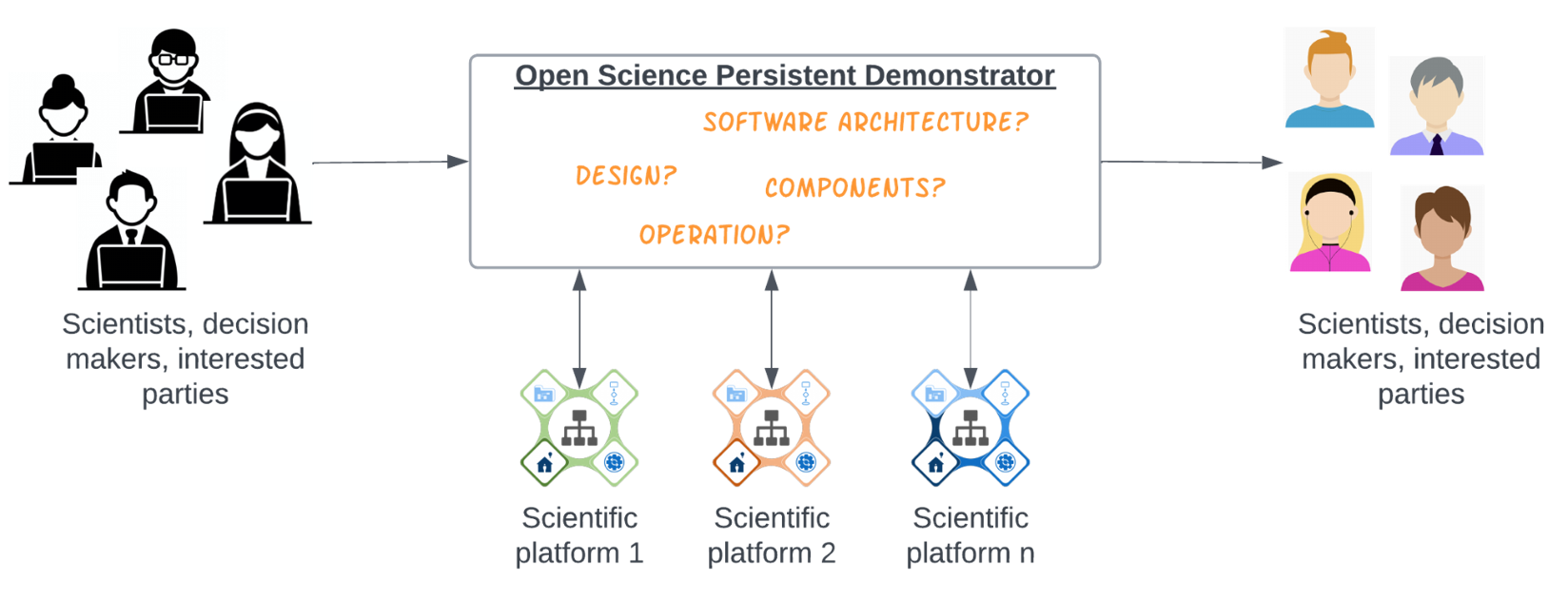
Core elements and RFI questions for the Open Science Persistent Demonstrator
The OSPD project is exploring the principles of reusability, portability, and transparency, within an Open Science Persistent Demonstrator. The goal is to enable and demonstrate prototyping technology solutions that create capacity for better and faster Earth Science research, comparison scenarios, as well as higher adoption of EO-based results and impact on society. Ultimately, the Open Science Persistent Demonstrator will provide an infrastructure that demonstrates and tests scientific workflows across several existing platforms. The goal is to demonstrate how platforms operated by different organizations can be used for collaborative research and data representation.
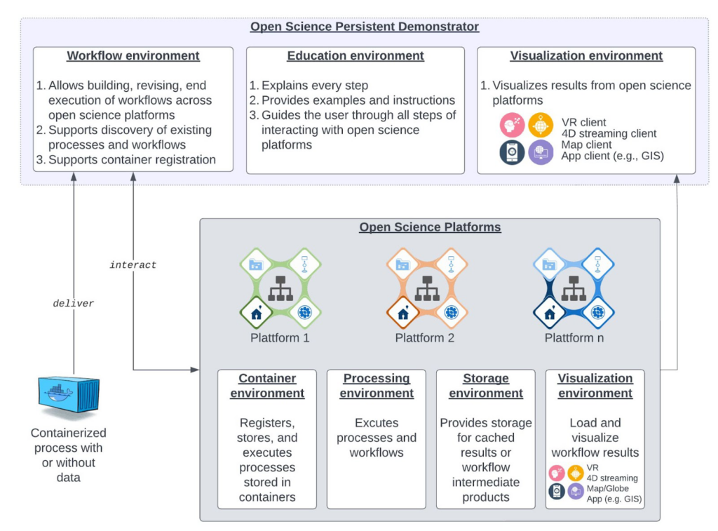
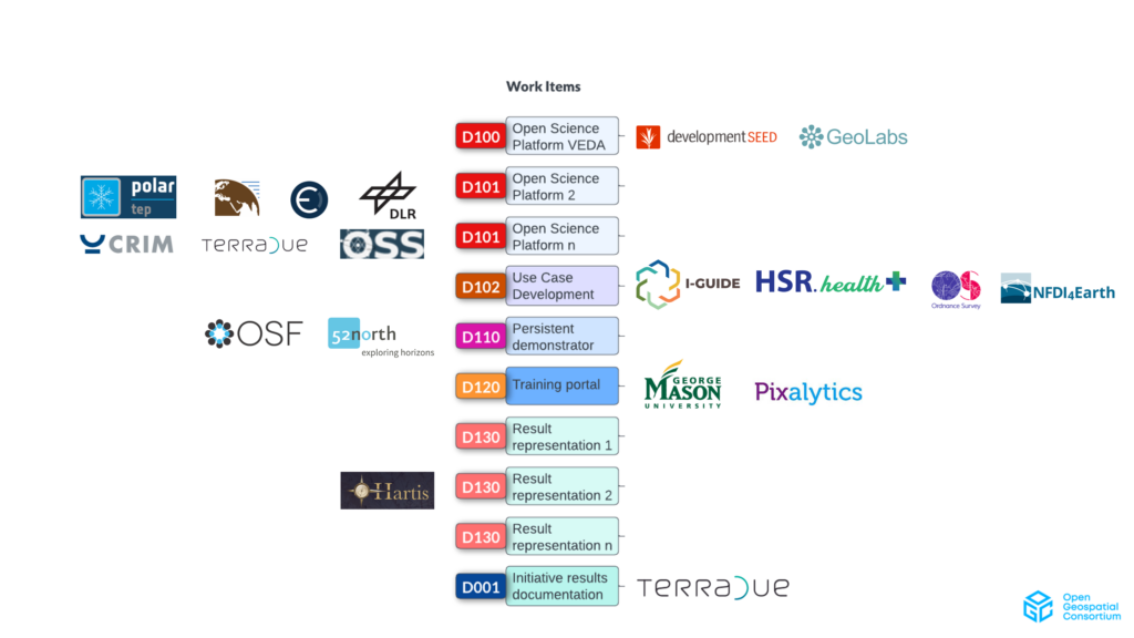
Work on the OSPD in 2024 will integrate open data and open science data-driven services provided by the project’s participants with the Galaxy Project platform and document them on osf.io, improving discoverability. The aim of these integrations is to more tightly connect the work of the OGC’s geospatial open science community with the broader open science community. The project will produce open science workflows that integrate multiple open science platforms, training materials designed for continuing professional development and university level learning and teaching, and communication materials.
The design and roadmap of the project will be outlined in an initial engineering report. A summary of the key outcomes of the project will be provided in an engineering report. You can follow along with the projects work on the OSPD site.
This initiative is being conducted under the OGC Collaborative Solutions and Innovation Program (COSI).
Sponsors
The OSPD is generously supported by sponsorship by OGC Strategic Members the European Space Agency (ESA) and the National Aeronautics and Space Agency (NASA).


Participants
Terradue SRL

Call for Participation – closed
[October 18, 2023] The Open Geospatial Consortium (OGC) issued a Call for Participation (CFP) for the Open Science Persistent Demonstrator (OSPD) Initiative. This Call for Participation invites organizations and individuals to join this multi-year project, which will support collaborative open science for the scientific community, decision-makers, and the general public. Collaborative Open Science is essential to addressing complex challenges whose solutions lie in cross-sector integrations that leverage expertise and data from diverse domains while prioritizing integrity. By making it simple to connect data and platforms together in transparent, reusable and reproducible workflows, the OGC OSPD aims to enable innovation through collaborative open science. OGC’s OSPD Initiative focuses on connecting geospatial and earth observation (EO) data and platforms to enable and demonstrate solutions that create capacity for novel research and accelerate its practical implementation.
A Bidders Q&A Webinar was held on November 15, 2023, at 12:30PM US Eastern.
Responses to the CFP were due by December 1, 2023, @11:59 PM AoE. All details on eligibility, benefits of participating, and how to apply are available in the CFP document. Once you have prepared your proposal, you should make your submission at this link.
