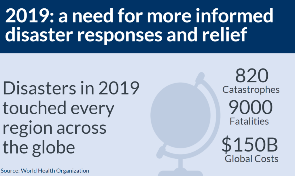
The last three years have been unprecedented when it comes to disasters. In 2019 alone there was billions of dollars’ worth of damage, and thousands of fatalities were caused by hundreds of catastrophes ranging from earthquakes to wildfires.
To address this decades-long trend of ever larger and deadlier disasters, OGC and the greater location information community work together to showcase how open standards can mitigate damage and loss of life during a critical event and allow quicker, more efficient responses. With interoperability at the core, OGC, industry, government and academia members highlighted how location is everything when protecting populations of the modern world from hurricanes, wildfires, and other disasters.

OGC, strategic members, Federal Geographic Data Committee, and the Department of Homeland Security on one mission: to deliver the right information to the right person at the right time. This work built on recommendations during an OGC Disasters Interoperability Concept Development Study (CDS) that was documented in the report OGC Development of Disaster Spatial Data Infrastructures for Disaster Resilience.

Fast forward to 2021. Earth and humanity continue to face growing threats. Climate change, a direct cause of many core disasters across the globe continues to increase the impacts and risks of disasters such as wildfires and floods. To make matters even more complicated, the COVID-19 pandemic has shown the world that humans are more vulnerable than ever to the outbreak and spread of infectious disease.
Facing these new challenges, OGC and its members have turned to planning for a new pilot powered by the key takeaways from 2019:
- A need to enhance disaster response with new technologies such as artificial intelligence, machine learning, cloud computing, and analysis ready data solutions
- More disaster information needs to be provided front line responders, decision makers and the public need accessible relevant accurate timely and trusted disaster information
- Fast and easy sharing of disaster data across borders and technologies is key to agile disaster response
- Actionable indicators need to be developed and made available via scalable tools and interoperable platforms capable of efficiently integrating and processing big data
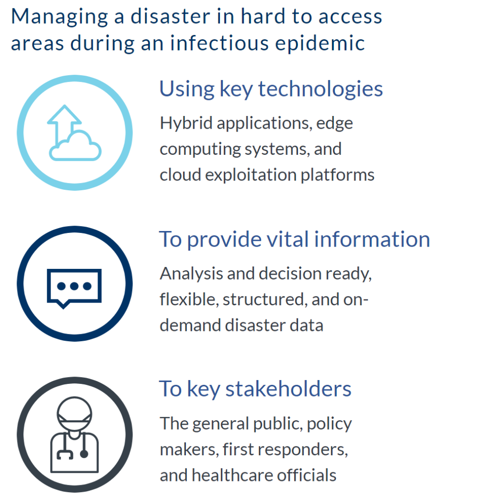
With these lessons from 2019 the Disaster Pilot 2021 has been launched with the support of USGS, FGDC, NASA, Natural Resources Canada, and other OGC Strategic Members with a new category of crisis scenario: managing a disaster in difficult terrain while an infectious epidemic is ongoing. To address this challenging scenario, OGC and the greater community must combine and deploy key technologies to provide vital information to key stakeholders.

The theme of the Disaster Pilot 2021 is ‘From Eyes in the Sky to Feet on the Ground’ which means taking core data from Earth’s satellite infrastructure, combining it with critical context such as population vulnerability, and providing decision-ready indicators to first responders, healthcare professionals, and more, so they can help better plan for and act on threats to humanity. The Pilot will emphasize a disaster scenario involving pandemics and flooding / landslides, as well as other circumstances that complicate or cascade from such events.
With the call for sponsors completed, OGC now needs its community of experts to participate and show how their solutions can work together and get disaster-relevant information to the people that need it most. It will be an unparalleled opportunity to test end-to-end information flow related to all phases of disaster management, with an emphasis on first responders and other end users, including the impacted public.
Looking ahead, the location community must work together to succeed in addressing future disasters that threaten both the planet and the health of humanity. If you or your organization is interested in participating in the 2021 OGC Disaster Pilot, you can get involved here. If you would like to spread the word about the OGC Disaster Pilot 2021, view and share our infographic.


