Spatial Data is distributed across users, tools, and regions for a variety of purposes via Spatial Data Infrastructure (SDI), but there are additional economic and societal benefits that can be unlocked.
SDIs are created to streamline people, process, technologies, and deliver a wide array of data. With new challenges posed by 21st century technologies and data availability, questions about how SDIs can be further optimized to meet modern needs are emerging. Now more than ever this data also needs to be delivered safely and securely. The OGC Modernizing SDI Concept Development Study aims to overcome these challenges to identify technology gaps and define the future of SDIs.
Natural Resources Canada and the OGC worked together to learn how to best support the modernization of SDI(s) by enabling and increasing data interoperability for Regional Assessments and Cumulative Effects, changes in the environment caused by interactions between human activities and natural processes that have long-lasting impacts on the environment and the health and well-being of individuals. The study aimed to advance the understanding of stakeholder issues and determine how SDIs can better serve their needs.
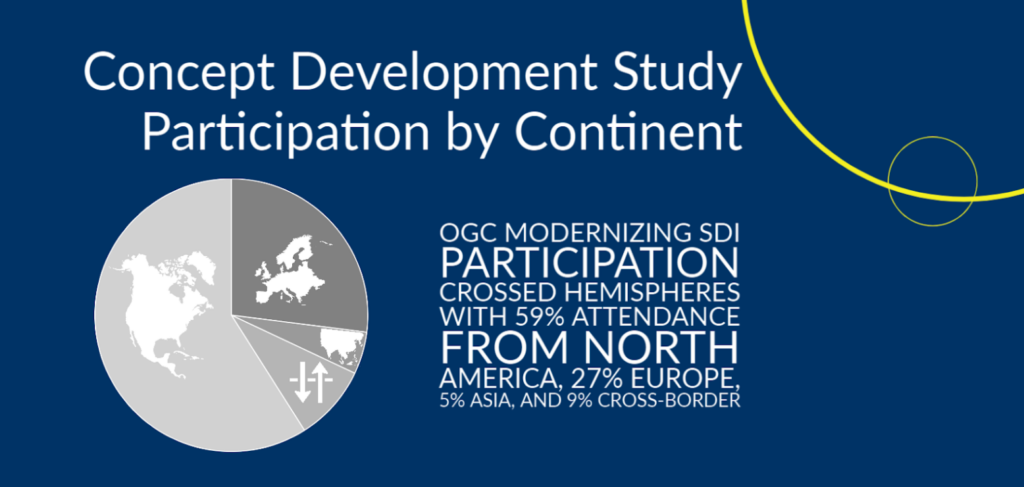
OGC and Natural Resources Canada gathered a variety of organizations across the world for a truly diverse and open group of participants to help solve these problems.

Today’s SDIs span across jurisdictions, regions, and communities, and environmental data is a core example of this. As environmental data changes drastically depending on economic, health, and social impacts, analysis of vast amounts of data has become a necessity to help meet key challenges, such as combating climate change and preventing and mitigating the impacts of disasters.
In Canada, any major infrastructure development requires an impact assessment that helps determine whether it will negatively impact its environment and all those who live there. This requires multiple types of data that can exist in many different forms and use a diverse set of standards. This vital information as a result becomes difficult and costly to access and decipher.
This Concept Development Study is created to help identify new standards and standards-based solutions that allow an SDI to function efficiently while enabling modern technologies and data characteristics. This would greatly increase the effectiveness of an individual SDI, resulting in increased benefits and reduced negative impacts within the domain. As one example, a modernized SDI will support more readily available climate information to reduce climate change impacts and improve the health of our planet.
The Modernizing SDI Concept Development Study identified multiple key results to help evolve SDIs and improve their applicability. Two of these core focus areas were the use of and delivery of new, open standards, and key, interoperable technologies that can help deliver this information quickly and securely. The entire list can be found here.

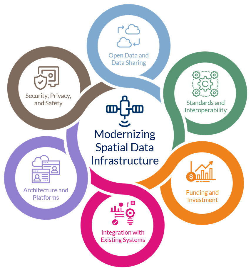
As a result of these findings, core requirements of how to modernize an SDI are developed. These revolve around enabling open standards, funding and integrating them, building and delivering them effectively through diverse technologies (e.g., platforms, dashboards, etc.), managing their safety and security, and ensuring that the information is as open as possible and easy to share.
The entire report can be viewed here.
About NRCan
Natural Resources Canada (NRCan) develops policies and programs that enhance the contribution of the natural resources sector to Canada’s economy, improve the quality of life for all Canadians, and conduct innovative science in facilities across Canada to generate ideas and transfer technologies. The department is an established leader in the fields of: Energy Sources and Distribution; Forests and Forestry; Minerals and Mining; Earth Sciences; Energy Efficiency; and Science and Data. NRCan also represents Canada at the international level to meet the country’s global commitments related to the sustainable development of natural resources.
In this project, NRCan is represented by the Canada Centre for Mapping and Earth Observation, specifically through the Federal Geospatial Platform and the Canadian Geospatial Data Infrastructure’s GeoConnections program.
Visit nrcan.gc.ca to learn more.


