In the ever-evolving realm of energy infrastructure, the success of an organization is often determined by its ability to adapt, innovate, and collaborate effectively. Enterprise Products Partners, L.P. has exemplified these qualities through their ongoing relationship with the Open Geospatial Consortium (OGC).
Under the leadership of Gary Hoover, Enterprise Products’ team of geospatial technology experts has helped develop an open, international geospatial Standard for the pipeline industry, PipelineML, and deployed disruptive open-source geospatial technology.
Doing so helped Enterprise Products optimize the management of their extensive 50,000-mile pipeline network, and supports the larger goal of safe and sustainable energy infrastructure within the oil and gas sector.
Pioneering the PipelineML Standard
Enterprise Products became a voting member of OGC in 2013. Shortly after, Data Architect John Tisdale rolled up his sleeves and got to work, learning OGC’s consensus-based Standards process and serving as a charter member and co-chair of the PipelineML Standards Working Group (SWG). In 2019, the PipelineML Conceptual and Encoding Model Standard was approved by the OGC Membership, making it an official OGC Standard.
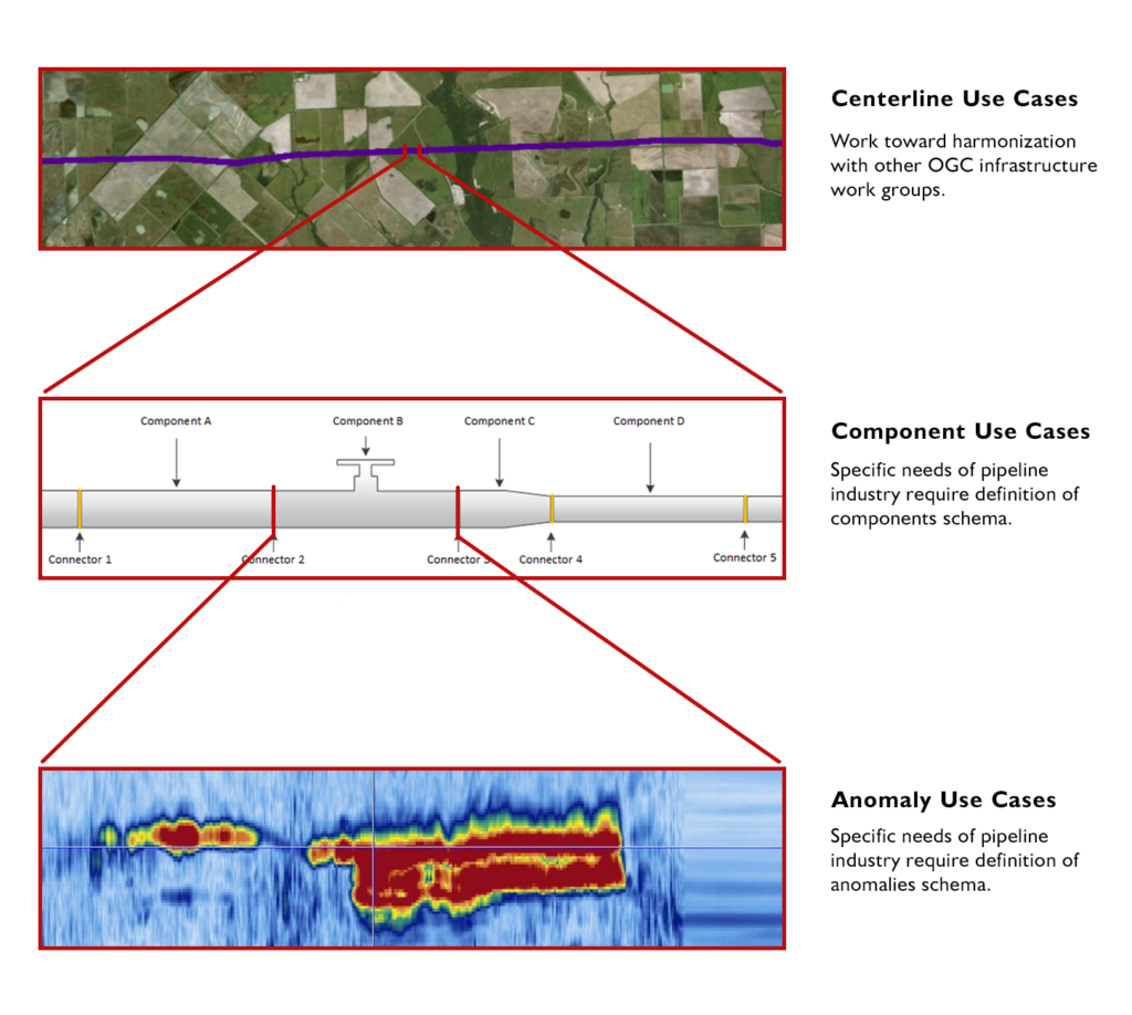
The PipelineML Standard – collaboratively developed by Enterprise Products and contributors from across the US, Canada, Belgium, Norway, Netherlands, UK, Germany, Australia, Brazil, and Korea – defines concepts that support the interoperable interchange of data related to oil and gas pipeline systems. PipelineML addresses two critical business use cases specific to the pipeline industry: new construction surveys and pipeline rehabilitation.
The Standard defines individual pipeline components, provides support for lightweight data aggregation, and provides a mechanism for extensions focused on safety and sustainability through effective data management practices. By working with OGC’s Land and Infrastructure Domain Working Group, PipelineML was aligned with related Standards that ensure compatibility with future land management requirements.

A Step Towards Modernization
June 26, 2023, marked a significant milestone in Enterprise Products’ technical history: in partnership with select technology vendors, the company implemented open-source technology to revamp their existing Asset Information Management (AIM) Program.
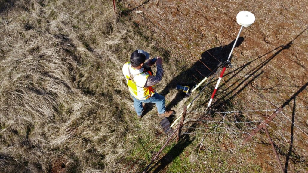
To move off the legacy PODS data model and a dependence on proprietary software, the Enterprise Products team spent years developing, prototyping, and refining the Pipeline Component Data Model (PCDM). Instead of utilizing an ageing linear referencing methodology, PCDM leverages modern geospatial technologies to gather GPS coordinates in the field that accurately mark the real-world location of pipeline components. This “Digital Twin” approach makes PCDM more adaptable to evolving business requirements.
Emerging from this initiative, the AIM Data Architecture Platform and Development Framework now provides data and services that serve as the lifeblood of the organisation.
The Pillars of Value-adding
Enterprise Products’s Asset Data Management group has played a vital role in elevating the company’s performance with contributions that have rippled across the organization to deliver tangible value in several areas:
Standards & Governance
To facilitate seamless information exchange across business units and external service providers, Enterprise Products has established stringent data standards and governance protocols that ensure consistent and accurate data for decision-making. By aligning their asset data with OGC Standards, Enterprise Products has established a universal language for geospatial data that simplifies communication and interoperability.
Data Integration
Incorporating integrated inline inspection data has been pivotal in maintaining the integrity of Enterprise Products’ extensive pipeline network. The AIM Data Architecture Platform functions as a nexus for data integration that enables a seamless flow of information across departments that promotes collaboration and efficiency.
Spatio-temporal Analytics
The integration of spatio-temporal analytics has introduced a new dimension to Enterprise Products’ pipeline management. Real-time geospatial insights have not only improved operational efficiency but have also fostered proactive problem solving. By incorporating database-native geoprocessing, Enterprise Products has streamlined analytical workflows and enhanced the speed and accuracy of decision-making.
Data Deliverability
Enterprise Products has democratized data access within the organization by creating a map-based interface that provides intuitive visualisations and reports that empower stakeholders to make informed decisions. This map-based interface supports over 1200 individual users across various departments, including Asset Integrity, Business Development, Field Operations, and Public Awareness.
Safety and Sustainability
Spanning the pipeline asset life-cycle from new construction to divestitures, the AIM Data Architecture supports several Safety and Sustainability programs that ensure safe, reliable operations. Programs such as Public Awareness, OneCall (aka 811 “Call Before You Dig”), Inline Inspections, Pipeline Rehabilitation, Regulatory Compliance, Integrity Assessments, and Field Operations all depend on highly available asset information.

Scaling for the Future
The volume, variety, and velocity of data required to manage and optimize large pipeline networks presents substantial challenges. However, Enterprise Products’ open architecture effortlessly manages the scale of their installation and provides ample room for growth. To put this into perspective, consider the following statistics:
- 50,000 Miles of Pipeline
- 2,500 Facilities
- 5.6 million Pipe Components
- 45 million rows of inline inspection data – 30 years’ worth
- 80 million Rows of geospatially referenced data, with 10x better lossless compression over the legacy proprietary system
Embracing Open
One of the most striking aspects of Enterprise Products’ journey is their embrace of Open Standards and Open Source technology. The AIM Data Architecture Platform represents a complete departure from proprietary systems. Key standards and technologies used by Enterprise Products include PipelineML, GeoServer, QGIS, PostgreSQL, PostGIS Spatial Extender, Python & other open libraries, and XML, GML, JSON, & GeoJSON encoded schemas.
This strategic shift not only reduced dependence on commercial vendors and licensing costs, but also established Enterprise Products as an industry pioneer that set a new standard for innovation and interoperability.
OGC Membership: A Driving Force
Enterprise Products’ journey is a compelling story of innovation and progress, with the OGC Community playing a pivotal role. Through collaborative efforts and a steadfast commitment to OGC’s consensus-based process, Enterprise Products led the development of the PipelineML Standard that has proven vital to optimizing the management of Enterprise Products’ extensive pipeline network.
Working with OGC has provided Enterprise Products with a significant competitive advantage, allowing them to leverage the collective knowledge and resources of the international geospatial community. Their journey underscores the transformative potential when industry leaders partner with organizations like OGC to drive positive change. As the world continues to seek sustainable and efficient energy infrastructure, Enterprise Products serves as a prime example of what is achievable when technology, data, and partnerships come together.


