May 4, 2021

OGC appoints three new members to its Board of Directors

The new appointees' diverse sets of experiences will inform the strategy of the Consortium and help instill innovation.
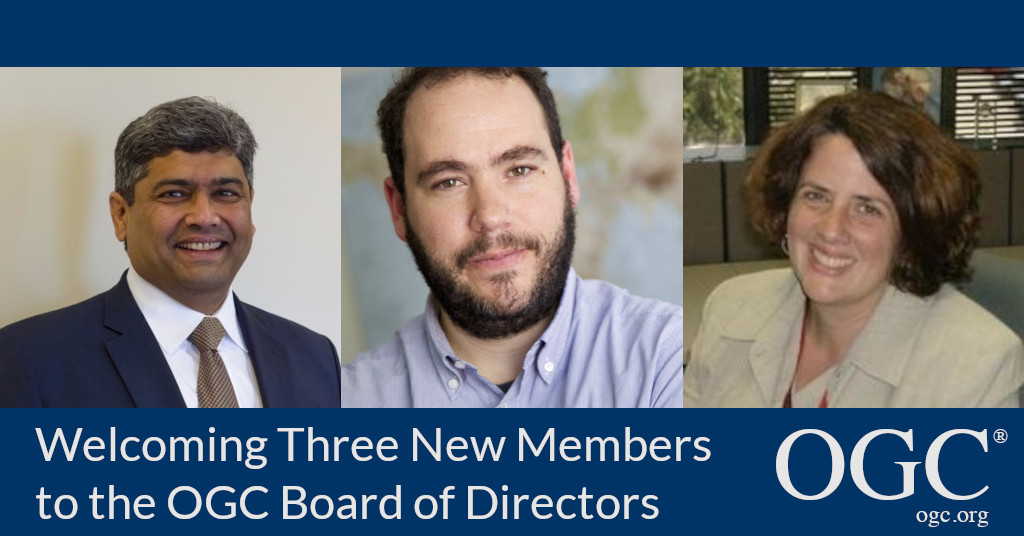
OGC Welcomes Patty Mims, Javier de la Torre, and Prashant Shukle to its Board of Directors

The Open Geospatial Consortium (OGC) has announced the election of Patty Mims, Javier de la Torre, and Prashant Shukle to its Board of Directors.

The new appointments bring experience in defense & intelligence, homeland security, cloud-native GIS, data science, environmental data analysis, Artificial Intelligence (AI), Machine Learning (ML), Earth Observation, and more.

“Technology-enabled global location services offer the opportunity for us to enable solutions to improve the effectiveness and security of our global village,” commented OGC Chair, Jeffrey Harris. “The addition to our Board of these talented and respected geospatial community leaders will add great value. Their diverse sets of experiences will inform the strategy of the Consortium to help instil innovation across people and devices to speed delivery, discovery, and decision-making.”

Patty Mims is the Director of Global National Government at Esri. In this role, Patty oversees all Esri's work across the U.S. Federal Government, including Intelligence, Defense, Public Safety, & Federal Civilian; Non-Profit Programs globally; as well as International support to National Government organizations around the world. Patty also currently serves on the Board of Directors for US Geospatial-Intelligence Foundation (USGIF) as well as the Chairperson for the Board of Advisors for the College of Natural Resources, Virginia Tech. Patty has spent her twenty-five year career in the GIS industry supporting the missions of defense, intel, homeland security, federal, and international customers. Patty is based in Virginia, USA.

Javier de la Torre is Founder and Chief Product Officer of CARTO, based in Madrid, Spain. After starting his career in Biodiversity and Environmental data analysis, Javier decided to build CARTO to enable geospatial interoperability in the cloud. He leads R&D, accelerating open source and a cloud-native approach in the GIS industry. Javier is passionate about conservation and climate change and is a board member of the Tierra Pura foundation, as well as having founded Vizzuality, a data science company working on some of the world's most pressing environmental use cases.

Prashant Shukle is currently the Chief Operating Officer of KorrAI, an advanced geospatial artificial intelligence company based in Halifax, Nova Scotia, Canada. He also serves as a strategic advisor to Space Strategies Consulting Ltd., an Ottawa-based think tank specialising in earth observation and space strategies, and the World Geospatial Industry Council, advising on public-private partnerships while acting as the editor of the WGIC's Policy Watch publication. Prashant also sits on the Board of Directors of PLACE, a non-profit data trust specialising in hyperlocal mapping data in the public interest. A passionate advocate for the earth observation and geospatial industry, he previously served as the Director-General of the Canada Centre for Mapping and Earth Observation where, among his many roles, he managed Canada's only geospatial data standards program, GeoConnections. In 2018, Prashant was awarded the OGC Lifetime Achievement Award for his contributions to the global geospatial standards community.

The three new members of the OGC Board of Directors join existing board members:

  • Jeff Harris – Chairman of the OGC Board of Directors, Consultant to industry and the US Government
  • Nadine Alameh – CEO at OGC
  • Bart De Lathouwer – President at OGC
  • John Fratamico – Chief Technology Officer (Emeritus) at Leidos
  • Chris Holmes – Open Fellow & VP Product/Strategy at Planet
  • Sanjay Kumar – CEO at Geospatial Media and Communications
  • Kumar Navulur – Senior Director of Global Strategic Programs at DigitalGlobe
  • Ed Parsons – Geospatial Technology Evangelist at Google
  • Faraz Ravi – Fellow & Director, OEM Partnerships, Reality Modeling at Bentley
  • Velu Sinha – Partner at Bain & Company
  • Eric Souléres – SVP Head of Engineering Operations & Quality Communication, Intelligence and Security at Airbus Defence and Space
  • Jantien Stoter – Professor – TU Delft
  • Frank Suykens – CTO Platforms at Hexagon Geospatial
  • Rob van de Velde – Director at Geonovum
  • Steven Witt – CEO and Founder Anno.AI
  • Jen Ziemke – Associate Professor of International Relations at John Carroll University

About OGC
The Open Geospatial Consortium (OGC) is an international consortium of more than 500 businesses, government agencies, research organizations, and universities driven to make geospatial (location) information and services FAIR – Findable, Accessible, Interoperable, and Reusable.
OGC's member-driven consensus process creates royalty free, publicly available geospatial standards. Existing at the cutting edge, OGC actively analyzes and anticipates emerging tech trends, and runs an agile, collaborative Research and Development (R&D) lab that builds and tests innovative prototype solutions to members' use cases.
OGC members together form a global forum of experts and communities that use location to connect people with technology and improve decision-making at all levels. OGC is committed to creating a sustainable future for us, our children, and future generations.
Visit ogc.org for more info on our work.

About OGC

The Open Geospatial Consortium (OGC) is a membership organization dedicated to using the power of geography and technology to solve problems faced by people and the planet. OGC unlocks value and opportunity for its members through Standards, Innovation, and Policy & Advocacy. Our membership represents a diverse and active global community drawn from government, industry, academia, international development agencies, research & scientific organizations, civil society, and advocates

May 4, 2021

OGC appoints three new members to its Board of Directors

Subscribe to our Press Release

Subscribe here to receive future Press Releases by email: Subscribe
 

Contact: 

info [at] ogc.org

The new appointees’ diverse sets of experiences will inform the strategy of the Consortium and help instill innovation.

The Open Geospatial Consortium (OGC) has announced the election of Patty Mims, Javier de la Torre, and Prashant Shukle to its Board of Directors.

The new appointments bring experience in defense & intelligence, homeland security, cloud-native GIS, data science, environmental data analysis, Artificial Intelligence (AI), Machine Learning (ML), Earth Observation, and more.

“Technology-enabled global location services offer the opportunity for us to enable solutions to improve the effectiveness and security of our global village,” commented OGC Chair, Jeffrey Harris. “The addition to our Board of these talented and respected geospatial community leaders will add great value. Their diverse sets of experiences will inform the strategy of the Consortium to help instil innovation across people and devices to speed delivery, discovery, and decision-making.”

Patty Mims is the Director of Global National Government at Esri. In this role, Patty oversees all Esri’s work across the U.S. Federal Government, including Intelligence, Defense, Public Safety, & Federal Civilian; Non-Profit Programs globally; as well as International support to National Government organizations around the world. Patty also currently serves on the Board of Directors for US Geospatial-Intelligence Foundation (USGIF) as well as the Chairperson for the Board of Advisors for the College of Natural Resources, Virginia Tech. Patty has spent her twenty-five year career in the GIS industry supporting the missions of defense, intel, homeland security, federal, and international customers. Patty is based in Virginia, USA.

Javier de la Torre is Founder and Chief Product Officer of CARTO, based in Madrid, Spain. After starting his career in Biodiversity and Environmental data analysis, Javier decided to build CARTO to enable geospatial interoperability in the cloud. He leads R&D, accelerating open source and a cloud-native approach in the GIS industry. Javier is passionate about conservation and climate change and is a board member of the Tierra Pura foundation, as well as having founded Vizzuality, a data science company working on some of the world’s most pressing environmental use cases.

Prashant Shukle is currently the Chief Operating Officer of KorrAI, an advanced geospatial artificial intelligence company based in Halifax, Nova Scotia, Canada. He also serves as a strategic advisor to Space Strategies Consulting Ltd., an Ottawa-based think tank specialising in earth observation and space strategies, and the World Geospatial Industry Council, advising on public-private partnerships while acting as the editor of the WGIC’s Policy Watch publication. Prashant also sits on the Board of Directors of PLACE, a non-profit data trust specialising in hyperlocal mapping data in the public interest. A passionate advocate for the earth observation and geospatial industry, he previously served as the Director-General of the Canada Centre for Mapping and Earth Observation where, among his many roles, he managed Canada’s only geospatial data standards program, GeoConnections. In 2018, Prashant was awarded the OGC Lifetime Achievement Award for his contributions to the global geospatial standards community.

The three new members of the OGC Board of Directors join existing board members:

  • Jeff Harris – Chairman of the OGC Board of Directors, Consultant to industry and the US Government
  • Nadine Alameh – CEO at OGC
  • Bart De Lathouwer – President at OGC
  • John Fratamico – Chief Technology Officer (Emeritus) at Leidos
  • Chris Holmes – Open Fellow & VP Product/Strategy at Planet
  • Sanjay Kumar – CEO at Geospatial Media and Communications
  • Kumar Navulur – Senior Director of Global Strategic Programs at DigitalGlobe
  • Ed Parsons – Geospatial Technology Evangelist at Google
  • Faraz Ravi – Fellow & Director, OEM Partnerships, Reality Modeling at Bentley
  • Velu Sinha – Partner at Bain & Company
  • Eric Souléres – SVP Head of Engineering Operations & Quality Communication, Intelligence and Security at Airbus Defence and Space
  • Jantien Stoter – Professor – TU Delft
  • Frank Suykens – CTO Platforms at Hexagon Geospatial
  • Rob van de Velde – Director at Geonovum
  • Steven Witt – CEO and Founder Anno.AI
  • Jen Ziemke – Associate Professor of International Relations at John Carroll University

About OGC
The Open Geospatial Consortium (OGC) is an international consortium of more than 500 businesses, government agencies, research organizations, and universities driven to make geospatial (location) information and services FAIR – Findable, Accessible, Interoperable, and Reusable.
OGC’s member-driven consensus process creates royalty free, publicly available geospatial standards. Existing at the cutting edge, OGC actively analyzes and anticipates emerging tech trends, and runs an agile, collaborative Research and Development (R&D) lab that builds and tests innovative prototype solutions to members’ use cases.
OGC members together form a global forum of experts and communities that use location to connect people with technology and improve decision-making at all levels. OGC is committed to creating a sustainable future for us, our children, and future generations.
Visit ogc.org for more info on our work.

About OGC

The Open Geospatial Consortium (OGC) is a membership organization dedicated to using the power of geography and technology to solve problems faced by people and the planet. OGC unlocks value and opportunity for its members through Standards, Innovation, and Policy & Advocacy. Our membership represents a diverse and active global community drawn from government, industry, academia, international development agencies, research & scientific organizations, civil society, and advocates

Sign up today

Receive the latest news on OGC.

© 2024 Open Geospatial Consortium. All Rights Reserved.

Become a memberBecome a member