Subscribe to our Press Release
Subscribe here to receive future Press Releases by email: Subscribe
info [at] ogc.org
New Moving Features Extension provides a JSON encoding as an alternative to XML or CSV
The Open Geospatial Consortium (OGC) is excited to announce that the OGC Membership has approved the Moving Features Encoding Extension – JSON for adoption as an official OGC Standard.
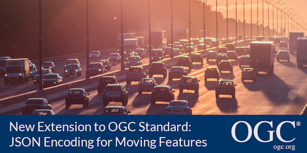
This standard defines how to encode and share the movements of geographic features by using JavaScript Object Notation (JSON). Such a ‘moving feature’ is one whose location changes over time; for example, a car, a pedestrian, an airplane, a ship, etc.
OGC Moving Features Encoding Extension – JSON provides an IETF GeoJSON encoding for OGC Moving Features as an alternative to XML or CSV encodings. A moving feature contains a temporal geometry, whose location continuously changes over time, as well as dynamic non-spatial attributes whose values vary with time. The JSON Encoding Extension supports, 0- (point trajectories), 1- (lines), 2- (polygons), and 3-dimensional (polyhedrons) objects with locations and/or properties that vary over time.
The ability to attribute time-varying properties to an object (rather than just varying its location or trajectory) has utility and value in many current application areas, including: Location Based Services, Intelligent Transportation Systems, Disaster Risk Management Systems, and Smart City Applications. For example, COVID-19 tracking and hotspot modelling, traffic congestion on roads, and hotspots of air pollution are all typical moving features seen in the real world.
The representation of the following phenomena are possible with this Encoding Standard:
- Discrete phenomena, which exist only on a set of instants, such as road accidents;
- Step phenomena, where the changes of locations are abrupt at an instant, such as administrative boundaries;
- Continuous phenomena, whose locations move continuously for a period in time, such as vehicles, typhoons, or floods.
As with any OGC standard, the open OGC Moving Features Encoding Extension – JSON is free to download and implement. Interested parties can view and download the standard from OGC’s Moving Features Standard Page.
About OGC
The Open Geospatial Consortium (OGC) is an international consortium of more than 500 businesses, government agencies, research organizations, and universities driven to make geospatial (location) information and services FAIR – Findable, Accessible, Interoperable, and Reusable.
OGC’s member-driven consensus process creates royalty free, publicly available geospatial standards. Existing at the cutting edge, OGC actively analyzes and anticipates emerging tech trends, and runs an agile, collaborative Research and Development (R&D) lab that builds and tests innovative prototype solutions to members’ use cases.
OGC members together form a global forum of experts and communities that use location to connect people with technology and improve decision-making at all levels. OGC is committed to creating a sustainable future for us, our children, and future generations.
Visit ogc.org for more info on our work.