Related Content:
-
Blog article
OGC GeoPose Outreach to W3C and Khronos Group
OGC’s GeoPose team recently engaged with W3C and the Khronos Group to promote adoption of the GeoPose 1.0 standard. Through presentations at Google HQ and...

-
Blog article
How Esri’s Adoption of 3D Tiles Accelerates the Open Geospatial Future
At its 2025 Partner Conference, Esri announced it will integrate Google’s Photorealistic 3D Tiles into the ArcGIS ecosystem. The move is more than a technical...

-
Announcement
Cassie Lee Joins OGC as Chief Innovation Officer
As OGC’s Chief Innovation Officer, Cassie Lee will leverage her expertise in aerospace, emerging technology, and AI to drive innovation and expand the Consortium’s impact.

-
Blog article
A Message from Prashant Shukle on Behalf of the OGC Board of Directors
The Board of the OGC has started to develop a transparent, objective, merit-based process for the next Chief Executive Officer of the Open Geospatial Consortium.

-
Blog article
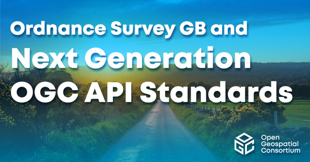
Ordnance Survey GB and Next Generation OGC API Standards
Pairing Ordnance Survey's new, easier-to-use data with OGC's new easy-to-use OGC APIs, OS has launched the OS NGD API – Features product, which provides access...
-
Announcement
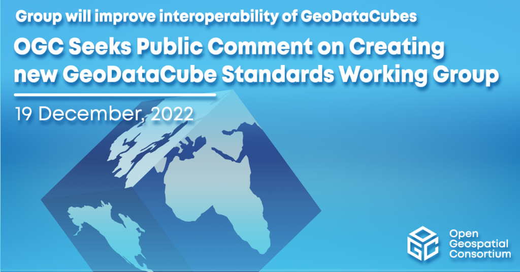
OGC Seeks Public Comment on Creating new GeoDataCube Standards Working Group
New Standard Working Group will improve data interoperability of GeoDataCube for Analysis Ready Data. The public comment period for the GeoDataCubes SWG will end 19...
-
Announcement
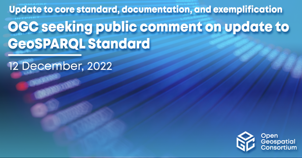
OGC seeking public comment on update to GeoSPARQL Standard
Update improves core standard, documentation, and exemplification. Comments should be submitted via the method outlined on the GeoSPARQL v1.1 Standard's public comment request page. Comments due 13 February,...
-
Announcement
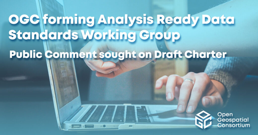
Public Comment Requested on Draft Charter for new OGC Analysis Ready Data Standards Working Group
New OGC Working Group will develop a multi-part Standard for geospatial Analysis Ready Data products, which can be integrated and analyzed with minimal user effort.
-
Announcement
OGC Testbed-19 Call For Sponsors: Interoperability and Collaboration from Oceans to Space
The Open Geospatial Consortium (OGC) is currently preparing its next major Innovation Initiative, Testbed-19, which builds upon the success and outcomes of Testbed-17, Testbed-18, and...

-
Announcement
OGC API – Tiles – Part 1: Core adopted as official OGC Standard
The release of OGC API - Tiles as an OGC Standard signals a new era in how tiled geospatial information is served over the Web.
-
Announcement
Superseded Best Practice Document will be retired to ensure consistency in implementation.

-
Announcement
Developers Invited to OGC API Web Mapping Code Sprint
OGC’s next hybrid code sprint will highlight and advance the latest in modern web mapping

-
Announcement
OGC Seeking Information Concerning Regional and International Marine Spatial Data Infrastructure
Survey will help shape the OGC Federated Marine Spatial Data Infrastructure (FMSDI) Pilot and potential future FMSDI activities to better serve the Marine Communitys needs.Impact...

-
Announcement
V2 supports “tile set metadata” that can be used to describe common properties of a tile set, the layers & styles used to produce the...
-
Announcement
OGC Seeks Public Comment on CityGML 3.0 Part 2: GML Encoding Standard
The Open Geospatial Consortium (OGC) seeks public comment on the OGC City Geography Markup Language (CityGML) 3.0 Part 2: GML Encoding Standard.The CityGML 3.0 GML...
-
Announcement
OGC Calls for Participation in Climate Resilience Pilot
The Open Geospatial Consortium (OGC) has released a Call for Participation (CFP) to solicit proposals for the OGC Climate Resilience Pilot, a collaborative activity recognizing...
-
Announcement
OGC Seeks Public Comment on v1.1 of 3D Tiles Community Standard
3D Tiles enables sharing, visualizing, fusing, and interacting with massive heterogenous 3D geospatial content across desktop, web, mobile, and metaverse applications.Previously referred to as “3D...
-
Announcement
OGC seeks public comment on Cloud Optimized GeoTIFF (COG) Standard
The Open Geospatial Consortium (OGC) is seeking public comment on the Cloud Optimized GeoTIFF (COG) Candidate Standard, which aims to formalize, as an OGC Standard,...
-
Announcement
New STAplus extension will be based on the OGC Best Practice for using Sensor Things API with Citizen Science.The Open Geospatial Consortium (OGC) seeks public...
-
Announcement
OGC seeks public comment on CoverageJSON Community Standard
The Open Geospatial Consortium (OGC) is seeking public comment on the candidate CoverageJSON Community Standard.Another simple use case is to put data values for each...
-
Announcement
OGC Seeks Public Comment on adoption of new version of CityJSON as Community Standard
The Open Geospatial Consortium (OGC) seeks public comment on an updated version (v1.1) of the CityJSON Community Standard.CityJSON v1.0 was accepted as an OGC Community...
-
Announcement
Ivan DeLoatch receives OGC Lifetime Achievement Award
OGC recognizes and celebrates Ivan’s lifetime of service and his steadfast support of geospatial open standards as a component of improved efficiency, governance, and decision-making.The...
-
Announcement
OGC elects Dr. Zaffar Sadiq Mohamed-Ghouse to its Board of Directors
Zaffar brings rich and diverse board experience, a focus on Space and Spatial sector integration, and a passion to support the earth observation community.The Open...
-
Announcement
Developers invited to the 2022 Joint OGC & ISO/TC 211 Code Sprint: The Metadata Code Sprint
The Open Geospatial Consortium (OGC) and Technical Committee 211 (TC 211) of the International Organization for Standardization (ISO) invite software developers to the 2022 Joint...
-
Announcement
GASGI joins OGC as a Principal Member to leverage the OGC’s collective geospatial expertise in building a healthy & competitive Geospatial Sector within KSA.The Open...
-
Announcement
OGC Calling For Participation in its Water Quality Interoperability Experiment
The Open Geospatial Consortium (OGC) has released a Call for Participation (CFP) to solicit proposals for the OGC Water Quality Interoperability Experiment (WQ IE), which...
-
Announcement
OGC joins new Metaverse Standards Forum as Founding Member
New Metaverse Standards Forum aims to foster the development of Open Standards for the metaverse through collaboration between Standards bodies, Industry, and Academia.The Open Geospatial...
-
Announcement
The Open Geospatial Consortium (OGC) seeks public comment on the Deprecation of v1.0 of the Geographic Information - Well Known Text Representation of Coordinate Reference...
-
Announcement
OGC Compliance Certification Available for GeoRSS v1.0
The Open Geospatial Consortium (OGC) is excited to announce that the Executable Test Suite (ETS) for version 1.0 of the OGC GeoRSS Encoding Standard has...
-
Announcement
OGC invites developers to the Quansight Automated Data Science Developer Sprint
The Sprint, part of OGC’s Disaster Pilot initiative, will showcase Quansight’s Nebari (formerly QHub) as a new approach to automating cloud deployment of analytical processing...
-
Announcement
Developers Invited to the July 2022 OGC API Vector Data Code Sprint
The July 2022 OGC API Virtual Code Sprint will further refine several OGC APIs as they move towards becoming official OGC Standards.The Open Geospatial Consortium...
-
Announcement
OGC seeks Public Comment on charter for proposed Geo for Open Metaverse Domain Working Group
The Open Geospatial Consortium (OGC) seeks public comment on the draft charter of the proposed OGC Geo for Open Metaverse Domain Working Group (Metaverse DWG).Much...
-
Announcement
OGC and OSGeo, the Open Source Geospatial Foundation, sign new Memorandum of Understanding
OGC and OSGeo have renewed their partnership in support of closer collaboration to advance Open Geospatial Standards and Open Source Geospatial Software.The Open Geospatial Consortium...
-
Announcement
The Open Geospatial Consortium (OGC) on the GeoPackage Well Known Text (WKT) for Coordinate Reference Systems (CRS) Extension candidate standard.The candidate standard revises and replaces...
-
Announcement
OGC Seeks Public Comment on the GeoPackage Conceptual Model Candidate Standard
The Open Geospatial Consortium (OGC) seeks public comment on the GeoPackage Conceptual Model Candidate Standard.The GeoPackage Conceptual Model Candidate Standard documents an OGC Conceptual and...
-
Announcement
OGC Seeks Public Comment on update to 3D Tiles Community Standard
3D Tiles enables sharing, visualizing, fusing, and interacting with massive heterogenous 3D geospatial content across desktop, web, mobile, and metaverse applications.3D Tiles 1.1 promotes several...
-
Announcement
Results of OGC’s biggest Innovation Initiative in 2021, Testbed-17, are now available
The Open Geospatial Consortium (OGC) has published the outcomes of 2021’s biggest research and development initiative, Testbed-17.The key outcomes, including detailed Engineering Reports, overview presentations,...
-
Announcement
The Sprint will focus on all parts of OGC API - Discrete Global Systems (DGGS), OGC API - Tiles, OGC API - Coverages, and OGC...
-
Announcement
OGC Seeks Public Comment on new Routing API and Exchange Model Standards
The Open Geospatial Consortium (OGC) seeks public comment on the candidate OGC API - Routes - Part 1: Core Standard and related candidate OGC Route...
-
Announcement
OGC seeks public comment on candidate OGC API – Tiles – Part 1: Core Standard
The Open Geospatial Consortium (OGC) seeks public comment on the candidate OGC API - Tiles - Part 1: Core Standard.As with other OGC API Standards,...
-
Announcement
OGC CEO Dr. Nadine Alameh appointed to US National Geospatial Advisory Committee
NGAC provides advice and recommendations to the US Federal Government on US national geospatial policy and management issues, the development of the US NSDI, and...
-
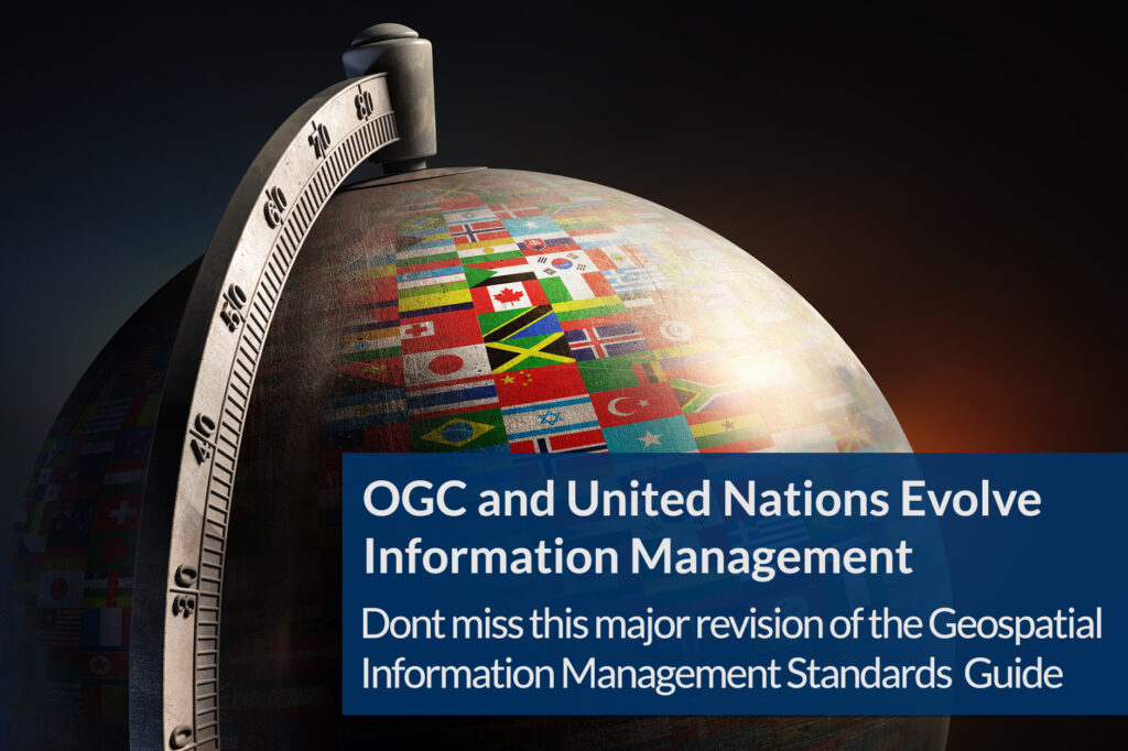
Announcement
The United Nations Committee of Experts on Global Geospatial Information Management (UN-GGIM) endorsed this edition during their Eleventh Session in August 2021, in decision 11/111.The...
-
Announcement
OGC Testbed-18 will pave the way towards new levels of interoperability in areas as diverse as New Space, Machine Learning, Open Science, and Building Energy....
-
Announcement
Developers are invited to the 2022 Joint OGC OSGeo ASF Code Sprint
The 2nd Open Source Software and Open Standards Code Sprint will advance multiple ASF and OSGeo projects, supported by OGC Standards, including OGC API Standards.The...
-
Announcement
OGC Publishes Best Practice for Earth Observation Application Packages
The new OGC Best Practice is a guide for developers that wish to package and deploy Earth Observation (EO) Applications for a selected Exploitation Platform.“OGC...
-
Announcement
Call For Participation: OGC Geotech Interoperability Experiment
The Geotech IE will ensure that geotechnical engineering data can seamlessly move between GIS and BIM environments in support of engineering and infrastructure projects.The Open...
-
Blog article
7 Key Takeaways from the OGC Climate Change Special Session
Article contributed by Steve Liang, SensorUp “If you can’t measure it, you can’t manage it.” The quote is originally from management consultant Peter Drucker and...
-
Announcement
Prashant Shukle elected as Vice Chair of the OGC Board of Directors
Prashant Shukle brings to the role an understanding of OGC’s international operations & partnerships that will benefit the Consortium’s governance and strategy.The Open Geospatial Consortium...
-
Announcement
The Open Geospatial Consortium (OGC) is excited to announce that the OGC Membership has approved the OGC API - Processes - Part 1: Core specification...
-
Blog article
Article Contributed by Chris Holmes, OGC Visiting Fellow – About six months ago I started as the first ‘Visiting Fellow’ of the Open Geospatial Consortium. It’s been...
-
Announcement
OGC Membership approves new version of 3D streaming Community Standard, I3S
A Scene Layer can be accessed in the form of a web service or Scene Layer Package (SLPK) – a file-based exchange format.The changes included...
-
Announcement
Chris Little receives OGC’s 2021 Gardels Award
Congratulations to Chris Little, awarded the 2021 Gardels Award for leading impactful efforts in the meteorology and geospatial science communities, including his exemplary chairing of...
-
Announcement
OGC Seeks Public Comment on OGC API – Common – Part 2: Geospatial Data
OGC API - Common - Part 2: Geospatial Data provides a common connection between the API landing page (defined by Part 1) and resource-specific details.The...
-
Blog article
Towards a Cloud-Native Geospatial standards baseline
Article Contributed by Chris Holmes, OGC Visiting Fellow – In my previous post I laid out the vision for Cloud-Native Geospatial, but with this post, I...
-
Announcement
UKHO becomes Strategic Member of Open Geospatial Consortium
By upgrading to Strategic Membership, UKHO will bring its expertise and leadership in accessing and utilising marine geospatial data in support of safe, secure and...
-
Announcement
OGC Calling For Participation in the Federated Marine Spatial Data Infrastructure Pilot
The OGC FMSDI Pilot will develop a federation of MPA datasets; assess current marine standards and data; and design a maturity model and roadmap for...
-
Blog article
Esri’s ArcGIS enables thousands of datasets, maps, and apps for location
Article Contributed by Adam Martin, ESRI Open standards aren’t just about efficiency. They allow organizations across the globe to share information effectively and securely, and...
-
Announcement
The Open Geospatial Consortium (OGC) is requesting public comment on a revision to the candidate Two Dimensional Tile Matrix Set and Tile Set Metadata Standard.The...
-
Announcement
Call For Participation in the OGC Routing Pilot Sprint
OGC Routing Pilot Sprint will help finalize the candidate standards for OGC API - Routes - Part 1: Core and the OGC Route Exchange ModelThe...
-
Announcement
Invitation to Participate in the November 2021 Geospatial API Virtual Code Sprint
The next OGC Code Sprint will focus on developing and testing implementations of the joint OGC API - Features / ISO 19168-1:2020 Geospatial API for...
-
Announcement
Seeking Participants for the OGC UxS Command and Control Interoperability Experiment
The OGC UxS Command and Control IE will test the suitability of a C&C data model for heterogeneous UxSs in a real-world environment.The Open Geospatial...
-
Blog article
Paving the way forward for Building Energy Mapping and Analytics
This Article was Contributed by Eddie Oldfield, Senior Lead, Projects & Advisory Services, QUEST; Jessica Webster, Energy Planning Analyst, Natural Resources Canada; and Ryan Ahola,...

-
Announcement
Dstl upgrades to Principal level of OGC Membership
As a Principal Member of OGC, Dstl will support the OGC’s innovation and standardisation activities to advance Geospatial interoperability and Open Standards for future defence...
-
Announcement
OGC and T-REX partner to bring Geospatial Innovation and Standards to St. Louis
Under the MoU, OGC will connect with T-REX Geospatial startups to conduct GEOINT-focused research, development, training, and Innovation activities.T-REX operates the Geospatial Innovation Center (“Geosaurus”)...
-
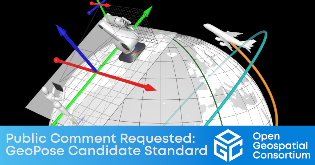
Announcement
Public Comment requested on new OGC GeoPose Candidate Standard, of use in 3D location applications
OGC GeoPose provides an interoperable way to express, record, and share the position and orientation of objects across diverse applications, users, devices, services, and platforms.
-
Announcement
Compliance testing now available for ‘OGC API – Features – Part 2’ standard
Implementers are invited to validate their products using the OGC API - Features executable test suite, which is available on the OGC Validator tool.The OGC...
-
Blog article
This article is contributed by Mark Reichardt – At the Eleventh Session of the United Nations Global Geospatial Information Management (UN-GGIM) Committee of Experts, member...
-
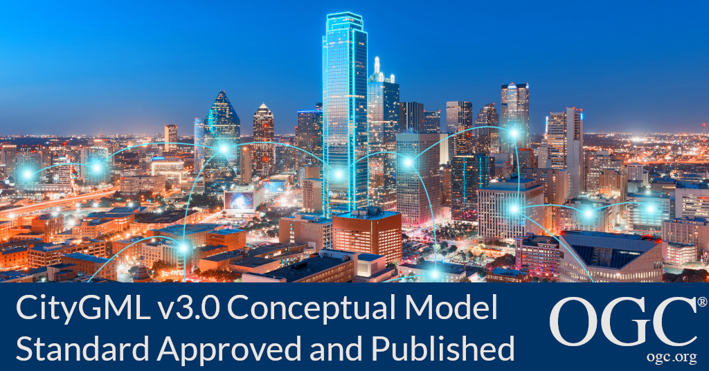
Announcement
OGC Membership approves the CityGML v3.0 Conceptual Model as official OGC Standard
The Open Geospatial Consortium (OGC) is excited to announce that the OGC Membership has approved the CityGML v3.0 Conceptual Model for adoption as an official...
-
Announcement
OGC and the National States Geographic Information Council sign Memorandum of Understanding
OGC and NSGIC partner to collaborate on promoting the uptake of location-based technology trends.The Open Geospatial Consortium (OGC) is excited to announce that it has...
-
Announcement
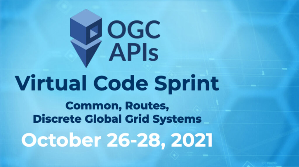
Announcement: Invitation to Participate in the October 2021 OGC API Virtual Code Sprint
The Open Geospatial Consortium (OGC) invites software developers to the October 2021 OGC API Virtual Code Sprint, to be held from October 26th to October...
-
Announcement
OGC Testbed-18 Call For Sponsors: Collaborate and Innovate to Further Advance Location Technologies
OGC Testbeds provide a unique opportunity for sponsors to tackle location data and processing challenges together with the world’s leading geospatial IT experts.The OGC Innovation...
-
Announcement
OGC announces support of the Locus Charter and the ethical use of Geospatial Information
OGC, alongside eight other high-profile geospatial organizations, have signed on to support the Locus Charter by EthicalGEO and Benchmark Initiative.The Open Geospatial Consortium (OGC) is...
-
Announcement
OGC seeks public comment on draft Simple Features 2021 standard
The Open Geospatial Consortium (OGC) seeks public comment on an update to the Simple Features Standard.In technical terms, Simple Features can model geometries which display...
-
Announcement
OGC Seeking Sponsors for a new IDBE Pilot linking Geospatial and Building Information Models
The OGC Integrated Digital Built Environment Pilot seeks to understand the current level of interoperability between Geospatial and BIM and forge a path for better...
-
Announcement
New revision to OGC GeoPackage Gridded Tiled Coverage Extension: Public Comment sought
The Open Geospatial Consortium (OGC) seeks public comment on version 1.1 of the OGC GeoPackage Extension for Tiled Gridded Coverage Data (TGCE).TGCE defines how to...
-
Announcement
OGC invites Tenders for the Provision of Compliance Testing Software Engineering Consulting Services
OGC is seeking the provision of consulting services in support of the Compliance Program’s TEAM Engine validator tool and related Executable Test Suites.The Open Geospatial...
-
Announcement
OGC to form new Planetary Domain Working Group; Public Comment sought on Draft Charter
New OGC DWG will identify requirements to revise or extend OGC standards for use with data concerning celestial bodies other than the Earth.The Open Geospatial...
-
Announcement
OGC Compliance Certification Available for v1.0 of the OGC CDB Standard
The Open Geospatial Consortium (OGC) is excited to announce that the Executable Test Suite (ETS) for version 1.0 of the OGC CDB Standard has been...
-
Announcement
OGC considering CoverageJSON as community standard; seeks public comment
The Open Geospatial Consortium (OGC) is considering CoverageJSON for adoption as an official OGC Community Standard.A new Work Item Justification to begin the Community Standard...
-
Announcement
Developers Invited To The July 2021 OGC API Virtual Code Sprint
Next OGC API Code Sprint will further advance OGC API - Processes, - Coverages, and - Records.The Open Geospatial Consortium (OGC) invites software developers to...
-
Announcement
Public Comment Requested on revision to OGC 3D streaming community standard, I3S
New version of the I3S Community Standard, used for streaming large 3D datasets to desktop and mobile devices, improves performance and scalability with enhancements to...
-
Announcement
OGC Compliance Certification Available for v1.1 of the OGC GeoTIFF Encoding Standard
The Open Geospatial Consortium (OGC) is excited to announce that the Executable Test Suite (ETS) for version 1.1 of the OGC GeoTIFF Standard has been...
-
Announcement
Products that implement the SensorML 2.0 Standard and pass the tests in the ETS can now be certified as OGC Compliant.The OGC Compliance Program is...
-
Announcement
OGC CEO Dr Nadine Alameh Appointed to Board of UN-GGIM Private Sector Network
The United Nations Committee of Experts on Global Geospatial Information Management Private Sector Network provides a conduit for the private sector to work with UN...
-
Announcement
OGC API - Common - Part 1: Core serves as a solid foundation upon which all OGC APIs can be built.OGC has documented these common...
-
Announcement
OGC and CRN partner to establish a Unique Geospatial Real Property Identifier
OGC and CRN will work together to develop a unique geospatial real property identifier that has applications in housing finance and beyond.The Open Geospatial Consortium...
-
Announcement
OGC Seeking Participants in the 2021 Disaster Pilot
OGC Disaster Pilot 2021 will prototype and demonstrate end-to-end capabilities that integrate OGC standards, data, services, and state-of-the-art technologies to support decision makers and responders...
-
Announcement
A key component of ML techniques and processes is sample data – data with known provenance, consistent metadata, and quality measurements that can be used...
-
Announcement
OGC seeks public comment on 3D GeoVolumes Standards Working Group Charter
New SWG will develop OGC API - 3D GeoVolumes, which will integrate various current approaches to accessing 3D geospatial content over the web into a...
-
Announcement
Developers Invited to Participate in the May 2021 OGC API Virtual Code Sprint
The next OGC Sprint will focus on further refining the draft specifications for OGC API - Maps, - Tiles, and - Styles.The Open Geospatial Consortium...
-
Announcement
US Army Geospatial Center Upgrades OGC Membership to Advance Open Systems
AGC’s new level of OGC membership supports advancing standards for cross-system interoperability and geospatial information sharing.The Open Geospatial Consortium (OGC) is pleased to announce that...
-
Announcement
OGC seeking participants in the Second Interoperable Simulation and Gaming Sprint
The Open Geospatial Consortium (OGC) announces its Call for Participation (CFP) in the OGC Interoperable Simulation and Gaming (ISG) Year 2 Sprint.This, the Year 2...
-
Announcement
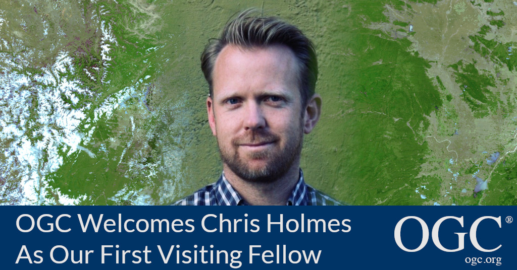
OGC welcomes Chris Holmes as its inaugural Visiting Fellow
Chris Holmes will bring to OGC invaluable insight and perspective to the on-going development of the OGC API family of Standards.
-
Announcement
Products that implement the O&M XML 2.0 Standard and pass the tests in the ETS can now be certified as OGC Compliant.The O&M XML 2.0...
-
Announcement
OGC seeks sponsors for a cooperative OGC – IHO Federated Marine SDI Demonstration Pilot
The Open Geospatial Consortium (OGC) is seeking sponsors for a cooperative OGC – IHO Federated Marine SDI Demonstration Pilot.The Federated Marine SDI Demonstration Pilot will...
-
Announcement
OGC Introduces Visiting Fellow Program
OGC Visiting Fellow(s) will bring diversity to OGC's technical and market thought-leadership, keeping the Consortium responsive and proactive to our community's - and wider society's...

-
Announcement
OGC Membership approves and publishes minor update to GeoPackage
V1.3 is a minor update to GeoPackage, the open, standards-based, platform-independent, portable, self-describing, compact format for transferring geospatial information.The Open Geospatial Consortium (OGC) membership has...
-
Announcement
OGC membership approves new Community Standard: Indoor Mapping Data Format (IMDF)
The Open Geospatial Consortium (OGC) membership has added Indoor Mapping Data Format (IMDF) 1.0.0 to the OGC Standards Baseline as a Community Standard.Indoor Mapping Data...
-
Announcement
Public Comment sought on new OGC API – Features – Part 3: Filtering and the Common Query Language
The Open Geospatial Consortium (OGC) seeks public comment on the candidate OGC API - Features - Part 3: Filtering and the Common Query Language (CQL)...
-
Announcement
Public comment sought on new work items for OGC API – Processes Standards Working Group
The Open Geospatial Consortium (OGC) seeks public comment on a revision to the OGC API - Processes Standards Working Group (SWG) Charter, which introduces new...
-
Announcement
CIS extension revision enables OGC imagery-related standards to more concisely represent remotely-sensed imageryThe Open Geospatial Consortium (OGC) seeks public comment on version 1.1 of the...
-
Announcement
Developers are invited to the 2021 Joint ASF – OGC – OSGeo Code Sprint
Code sprint will advance multiple ASF, OSGeo projects, and OGC standards - including OGC API standards, the building blocks for location.

-
Announcement
OGC GeoTIFF Standard Working Group updates work items; public comment sought on new charter
GeoTIFF SWG is planning on minor and major revisions to the popular standard used for sharing geographic image data.The Open Geospatial Consortium (OGC) seeks public...
-
Announcement
OGC Members propose update to work of Features API Standards Working Group; public comment sought
The Open Geospatial Consortium (OGC) seeks public comment on the proposed updated charter for the Features API Standards Working Group (SWG).The purpose of the Features...
-
Announcement
OGC seeks public comment on proposal to revise Indexed 3D Scene Layers (I3S) Community Standard
The Open Geospatial Consortium (OGC) seeks public comment on the proposal for a revision to the OGC Indexed 3D Scene Layers (I3S) Community Standard.A Scene...
-
Announcement
The Open Geospatial Consortium (OGC) seeks public comment on the draft updated charter for the CDB Standards Working Group (SWG).The purpose of the CDB SWG...
-
Announcement
OGC seeks public comment on new CityJSON Community Standard
The Open Geospatial Consortium (OGC) seeks public comment on its adoption of CityJSON as an OGC Community Standard.CityJSON 1.0 provides a directly implementable JSON encoding...
-
Announcement
OGC Seeking Information Concerning The Capture And Use Of Spatial Data During Health Emergencies
RFI for the OGC Health SDI Concept Development Study will support the development of a Health Emergencies Data Model and the design of a Health...
-
Blog article
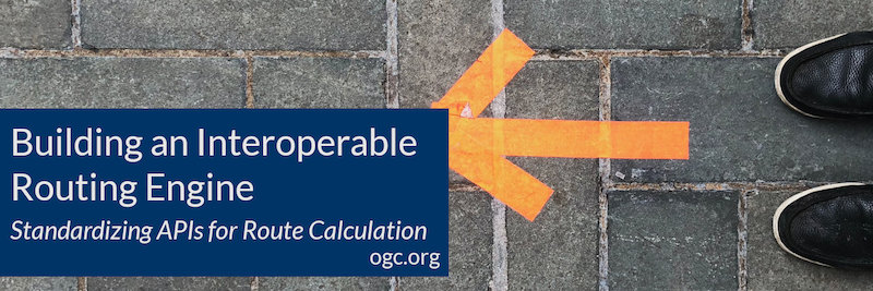
Building an Interoperable Routing Engine (Part 2)
Article Contributed by Ignacio “Nacho” Correas, Chief Technology Innovation Officer at Skymantics – There are two trade-offs that need to be carefully balanced: accuracy vs....
-
Announcement
OGC Members propose new Features and Geometries JSON Standards Working Group; public comment sought
New OGC Working Group will develop a JSON encoding for geospatial feature data to support additional concepts that are important for the wider geospatial community...
-
Announcement
OGC seeking additional sponsors for Disaster Pilot 2021
OGC Disaster Pilot 2021 will prototype and demonstrate end-to-end capabilities that integrate OGC standards, data, services, and state-of-the-art technologies to support decision makers and responders...
-
Announcement
OGC seeks Public Comment on revised Abstract Specification: Observations and Measurements
The Open Geospatial Consortium (OGC) seeks public comment on a revision to the joint ISO and OGC Standard, Observations and Measurements (O&M).The O&M Standard defines...
-
Announcement
Public comment sought on CityGML 3.0 Conceptual Model for storage and exchange of 3D city models
A key goal for the development of the CityGML Conceptual Model is to provide a common definition of the basic entities, attributes, and relations of...
-
Announcement
Charles Heazel receives OGC’s 2020 Gardels Award
Congratulations to Charles “Chuck” Heazel awarded the 2020 Gardels Award for their continued contributions to the creation and advancement of OGC StandardsAt the December Open...
-
Announcement
Draft specifications developed in Testbeds eventually move into the OGC Standards Program, where they are reviewed, revised, and potentially approved as new international open standards...
-
Announcement
OGC Welcomes AWS to the OGC Community as a Principal Member
AWS joins OGC as a Principal Member to help accelerate innovation by supporting OGC’s open and consensus-based process of standards development.The Open Geospatial Consortium (OGC)...
-
Announcement
OGC API - Features provides the fundamental API building blocks to create, modify, and query ‘features’ on the Web.The Open Geospatial Consortium (OGC) is excited...
-
Announcement
OGC simplifies EO data access and analysis through novel, standards-based technique
As part of the Earth Observation Applications Pilot, OGC Members have matured an architecture that allows software developers to easily package and share their applications.Further...
-
Announcement
OGC announces kickoff to the Geospatially Enabled Ecosystem for Europe (GeoE3) project
3 year EU-funded project will improve access, interoperability, and harmonization of data, and build a data ecosystem based on national platformsThe Open Geospatial Consortium (OGC)...
-
Announcement
OGC Geopackage Standards Working Group updates its Charter; public comment requested
The Geopackage Standards Working Group (SWG) provides a consensus forum for revisions to the GeoPackage Encoding Standard including approved extensions as well as the development...
-
Announcement
OGC invites developers to a virtual Code Sprint to refine the upcoming OGC API – EDR standard
The OGC API - Environmental Data Retrieval (EDR) candidate standard enables end-users to easily identify and retrieve a subset of data from ‘big data’ storesThe...
-
Announcement
OGC and NRCan invite you to the Modernizing SDI Workshop
Workshop will focus on Geospatial Data Interoperability for Cumulative Effects and examine novel, standards-based solutions that address the challenges of integrating disparate data.The Open Geospatial...
-
Announcement
Open Geospatial Consortium considering Apple’s Indoor Mapping Data Format as Community Standard
IMDF targets indoor mapping and provides a mobile-friendly, compact, and human-readable data model for any indoor space, providing a basis for orientation, navigation, and discovery.The...
-
Announcement
OGC membership approves new standard: Symbology Conceptual Model: Core Part
The Open Geospatial Consortium (OGC) membership has approved the Symbology Conceptual Model: Core Part (SymCore) as a new OGC Standard.The Symbology Conceptual Core Model (SymCore)...
-
Announcement
SensorML 1.0 and Sensor Web Enablement Common 2.0 Executable Test Suites released
Implementers are invited to validate their products using the new test suites, which are available on the OGC validator tool.Testing involves submitting a SensorML or...
-
Announcement
New OGC API standard for geospatial processing across the web; public comment sought before approval
OGC API - Processes simplifies the task of making simple or complex computational geospatial processing services accessible via web services.The Open Geospatial Consortium (OGC) seeks...
-
Announcement
OGC and ODA Announce Strategic Partnership
Partnership between OGC and the Open Design Alliance will promote cooperation on open geospatial standards and allow users to do more with BIM, CAD, and...
-
Announcement
Prashant Shukle receives OGC Lifetime Achievement Award
OGC recognizes and celebrates Prashant’s lifetime of service and his steadfast support of open geospatial standards and the OGC mission.The Open Geospatial Consortium (OGC) is...
-
Blog article
We Remember with fondness the incredible life and contributions of Lance McKee
The OGC family has lost a cherished friend and impassioned supporter of the use of location information and open standards for good. We recently learned...

-
Announcement
The resulting Health SDI will aim to serve as a Pandemic Early Warning, Response & Recovery Platform.As leaders in the interoperability of location information, OGC...
-
Announcement
OGC seeks public comment on new OGC API for Environmental Data Retrieval
The Open Geospatial Consortium (OGC) seeks public comment on the candidate OGC API - Environmental Data Retrieval Standard.The OGC API - Environmental Data Retrieval (OGC...
-
Announcement
OGC Welcomes Microsoft to the OGC Community as a Principal Member
As a Principal Member of OGC, Microsoft will help advance OGC APIs - the new generation of location standards for integrating location-aware information in any...
-
Announcement
OGC and FAA invite participants to the SWIM Discovery Service (SDS) Technical Review Workshop
Workshop participants will be informed of a specification critical to the future of service discovery in a global SWIM environment.The Open Geospatial Consortium (OGC) and...
-
Announcement
The update, developed jointly with ISO TC211, enables 4D DGGS, aligns itself with other ISO standards, and more.The Open Geospatial Consortium (OGC) membership has proposed...
-
Announcement
The Open Geospatial Consortium (OGC) seeks public comment on updates to two Best Practice documents concerning Defence Profiles: DGIWG 122 Defence Profile of OGC’s Web...
-
Announcement
OGC invites you to its Earth Observation Applications-to-the-Data Architecture Presentation Webinar
Webinar will present experiences and lessons learned on how to best exploit Big EO data stores and how to enable externally developed applications as additional...
-
Announcement
The Open Geospatial Consortium (OGC) seeks public comment on the draft updated charter for the OGC GeoSPARQL Standards Working Group (SWG).Since the release of GeoSPARQL...
-
Announcement
Developers invited to three OGC API Sprints in Q3 2020
A series of Sprints will build and test prototype implementations of four draft OGC API specifications to ensure that they are as developer-friendly, usable, and...
-
Announcement
Developers are invited to the OGC Interoperable Simulation and Gaming Sprint
The draft specification aligns with OGC Web API Guidelines and supports multiple 3D geospatial standards from the OGC portfolio, including 3D Tiles, I3S, CDB, and...
-
Announcement
Call for Sponsors of Testbed-17: Collaborate and Innovate to Advance the Power of Location
Testbeds boost research and development to make location data and information more FAIR: Findable, Accessible, Interoperable, and Re-usable.Testbeds provide a unique opportunity for sponsors to...
-
Announcement
The Open Geospatial Consortium (OGC) is excited to announce that the Executable Test Suite (ETS) for version 2.0 of the GML in JPEG 2000 (GMLJP2)...
-
Announcement
OGC adopts and publishes Hierarchical Data Format Version 5 (HDF5) Core Standard
The Open Geospatial Consortium (OGC) membership has approved the Hierarchical Data Format Version 5 (HDF5) Core as an official OGC Standard.Hierarchical Data Format Version 5...
-
Announcement
OGC Members propose new Routing Standards Working Group; public comment sought on draft charter
The Open Geospatial Consortium (OGC) seeks public comment on the draft charter for the new OGC Routing Standards Working Group (SWG).The Routing SWG will develop...
-
Announcement
OGC Members Revise IoT Standard SensorThings API Part 1 – Sensing; Public Comment Sought
The Open Geospatial Consortium (OGC) seeks public comment on Version 1.1 of the OGC SensorThings API, Part 1 - Sensing.The OGC SensorThings API provides an...
-
Announcement
OGC adopts Extension to its Moving Features Standard, enabling JSON Encoding
New Moving Features Extension provides a JSON encoding as an alternative to XML or CSVThe Open Geospatial Consortium (OGC) is excited to announce that the...
-
Announcement
US Federal Aviation Administration (FAA) upgrades to highest level of OGC Membership
FAA upgrades to OGC’s highest level of membership to help drive standards and shape development priorities relevant to aviationThe Open Geospatial Consortium (OGC) is pleased...
-
Announcement
OGC seeks public comment on Version 1.3 of GeoPackage Standard
V1.3 is a minor update to GeoPackage, the open, standards-based, platform-independent, portable, self-describing, compact format for transferring geospatial information.Open Geospatial Consortium (OGC) seeks public comment...
-
Announcement
OGC and W3C invite web developers to a joint workshop series on Maps for the Web
Workshops will bring together experts in browser development, Web standards, and Web mapping client tools & applications to explore the potential of standardized maps for...
-
Announcement
OGC seeks public comment on Version 1.2 of CDB Standard for use in modeling & simulation
The Open Geospatial Consortium (OGC) seeks public comment on the candidate CDB version 1.2 standard.CDB version 1.2 contains two substantive changes that are not deemed...
-
Announcement
Products that implement the OGC API - Features - Part 1: Core standard and pass the tests in the ETS can now be certified as...
-
Announcement
New MUDDI (Model for Underground Data Definition and Integration) SWG seeks to create models, standards, and mappings to fully represent underground infrastructure in context with...
-
Announcement
OGC and buildingSMART International publish discussion paper on the integration of BIM and GIS
The Discussion Paper, entitled Built environment data standards and their integration: an analysis of IFC, CityGML and LandInfra, is free to download from OGC’s Discussion...
-
Announcement
OGC members create new ‘OGC API – Styles’ Standards Working Group
The purpose of the Standards Working Group is to develop and maintain an OGC API - Styles core standard as well as extensions to that...
-
Announcement
Results of OGC’s biggest Innovation Initiative in 2019, Testbed-15, are now available
The key outcomes, including detailed Engineering Reports, overview presentations, and videos, are freely available on the Testbed-15 webpage.OGC Testbed results, documented in Engineering Reports, are...
-
Announcement
The Open Geospatial Consortium (OGC) and Natural Resources Canada (NRCan), an OGC Strategic Member, are requesting information to support the Modernizing SDI: Enabling Data Interoperability...
-
Announcement
OGC and Ordnance Survey Invite Developers to the OGC API – Tiles Sprint
The Open Geospatial Consortium (OGC) and Ordnance Survey, an OGC Strategic Member, invites interested developers to the OGC API - Tiles Sprint, to be held...
-
Announcement
OGC announces candidate OGC API – Features – Part 2 standard; public comment requested
The Open Geospatial Consortium (OGC) seeks public comment on the OGC API - Features - Part 2: Coordinate Reference Systems candidate standard.The OGC API family...
-
Announcement
OGC API – Common candidate standard outlines common elements for OGC APIs; public comment requested
OGC API - Common documents common elements to be used in the OGC API suite of standards.The Open Geospatial Consortium (OGC) is seeking public comment...
-
Announcement
Open Geospatial Consortium to Consider Apple’s Indoor Mapping Data Format as Community Standard
IMDF targets indoor mapping and provides a mobile-friendly, compact, and human-readable data model for any indoor space, providing a basis for orientation, navigation, and discovery.The...
-
Announcement
OGC Invites Developers to its Environmental Data Retrieval API Sprint
New OGC Sprint event will focus on emerging standards for a data-centric Environmental Data Retrieval API that will promote quick and easy access to environmental...
-
Announcement
OGC seeks public comment on revision to TimeseriesML standard
The Open Geospatial Consortium (OGC) seeks public comment on version 1.3 of the TimeseriesML standard.Through the use of existing OGC standards, TimeseriesML provides an interoperable...
-
Announcement
OGC considering CityJSON as community standard; seeks public comment for new Work Item
The Open Geospatial Consortium (OGC) is considering CityJSON for adoption as an official OGC Community Standard.A new Work Item justification to begin the Community Standard...
-
Announcement
OGC Announces Publication of Open Routing API Pilot Results
The Open Geospatial Consortium (OGC) has announced publication of the Engineering Reports documenting the work of the Open Routing API Pilot, including implementations developed and...
-
Announcement
New version of 3D streaming community standard, I3S, adopted and published by OGC
A Scene Layer can be accessed in the form of a web service or Scene Layer Package (SLPK) – a file-based exchange format.The changes included...
-
Announcement
OGC seeks public comment on Core Tiling Conceptual and Logical Models Abstract Specification Topic
Candidate Abstract Specification Topic defines a conceptual model for tiling space of any number of dimensions, as well as a logical model for tiling 2D...
-
Announcement
OGC announces the creation of new ‘OGC API – Records’ Standards Working Group
The purpose of this Standards Working Group is to develop a new version of the OGC Catalogue Service standard for the World Wide Web.OGC Chief...
-
Announcement
OGC announces the creation of new GeoPose Standards Working Group
The Open Geospatial Consortium (OGC) announces the formation of the GeoPose Standards Working Group (SWG).Participants in this new OGC SWG will focus on developing a...
-
Announcement
Participate in OGC’s Testbed-16 and shape the future of location technologies
The Open Geospatial Consortium (OGC) is calling for participation in its next major Innovation Initiative, Testbed-16.OGC Testbeds give room for research and new ideas, while...
-
Announcement
OGC announces virtualcitySYSTEMS as the winner of the 2019 OGC CityGML Challenge
The Manchester 3D Data Viewer was developed by virtualcitySYSTEMS as the winning entry to the 2019 CityGML Challenge.OGC’s CityGML standard is an open data model...
-
Announcement
Linda van den Brink receives OGC’s 2019 Gardels Award
Congratulations to Linda van den Brink, awarded the 2019 Gardels Award for being “an outstanding representative both internal to OGC and external.”Linda van den Brink...
-
Announcement
ESIP and OGC invite you to the Coverage Processing and Analysis API Sprint
This will be a key event in the development of OGC APIs for geospatial resources and building blocks for community APIs.The Coverage Processing and Analysis...
-
Announcement
OGC Renews Memorandum Of Understanding With FrontierSI
OGC and FrontierSI continue to work together to reach out, innovate, and educate at national, regional, and international levels.The Open Geospatial Consortium (OGC) announces that...
-
Announcement
The OGC UML-to-GML Application Schema Pilot 2020 (UGAS-2020) will improve and enhance the present capabilities of the open source tool ShapeChange in order to meet...
-
Announcement
First of new OGC APIs approved as an OGC standard: OGC API – Features – Part 1: Core
The Open Geospatial Consortium (OGC) is excited to announce that the OGC Membership has approved the first in its suite of OGC API standards, OGC...
-
Announcement
OGC adopts Two Dimensional Tile Matrix Set standard
The OGC Two Dimensional Tile Matrix Set standard defines the rules and requirements for a two dimensional tile matrix set as a way to index...
-
Announcement
The objective of this workshop is to understand the exact requirements of application developers in terms of data discovery, data loading, data processing, and result...
-
Announcement
OGC updates IndoorGML standard to v1.1; seeks public comment before approval
IndoorGML v1.1 is fully compatible with the previous version IndoorGML v1.0.The OGC IndoorGML Encoding Standard was developed to provide a common schema framework for interoperability...
-
Announcement
OpenFlight is a 3D scene description file format widely used in the aviation simulation industryThe Open Geospatial Consortium (OGC) is considering the OpenFlight Scene Description...
-
Announcement
3D Data Container and Tiles API Pilot seeks to assess a data container model and API that will support smooth transitions between 3D and 2D...
-
Announcement
OGC invites you to its Augmented Reality Summit in Toulouse, France
What partnerships or collaborative projects can OGC members establish or expand to inform and advance interoperable AR?How will OGC members benefit from their collaborative or...
-
Announcement
New Moving Features Extension provides a JSON encoding as an alternative to XML or Simple CSVThe Open Geospatial Consortium (OGC) is seeking public comment on...
-
Announcement
OGC 3D streaming Community Standard, I3S, receives update: public comment sought before approval
Latest version of I3S standard, used for streaming large 3D datasets, adds Point Cloud Scene Layer type, improved performance, and more.The Open Geospatial Consortium (OGC)...
-
Announcement
OGC announces exciting agenda for two-day Location Powers: Data Science summit
Location Powers: Data Science will be held 13-14 Nov at Google’s Crittenden Campus in Mountain View, CAThe Open Geospatial Consortium (OGC) has announced the agenda...
-
Announcement
GeoTIFF v1.1 adopted as an OGC Standard
The GeoTIFF 1.1 standard formalizes the existing GeoTIFF specification version 1.0 by integrating it into OGC’s standardization process.Approval of this GeoTIFF 1.1 standard begins the...
-
Announcement
CityGML-Urban Planning ADE Ideathon will be held in Japan
In October and February, the Ideathon will discuss expanding the applications of CityGML and Urban Planning ADE in Japan, as well as the demand for...
-
Announcement
OGC Invites Participants to Help Advance Vector Tiles Interoperability
Vector Tiles Pilot, Phase 2 will advance interoperability for vector tiles using established OGC standards and the latest OGC APIs - and help geospatial enterprises...
-
Announcement
OGC DGGS Standards Working Group seeks public comment on new tasks of work added to its charter
The Discrete Global Grid Systems SWG will work with relevant working groups as necessary to embed linkages between DGGS and other standards in the OGC...
-
Announcement
OGC announces next Location Powers Summit, focused on Data Science
Location Powers: Data Science will be held 13-14 Nov at Google’s Crittenden Campus in Mountain View, CAThe Open Geospatial Consortium (OGC) invites you to its...
-
Announcement
The Industrial Internet Consortium and the Open Geospatial Consortium Announce Liaison
Organizations will work together to help further IoT industry market adoptionThe Open Geospatial Consortium (OGC) and the Industrial Internet Consortium® (IIC™) announce they have agreed...
-
Announcement
OGC hosts successful launch of Smart Cities Tech Pilot
Left to right: Nadine Alameh, OGC CEO; Norman Speicher, Program Manager / Computer Scientist at DHS S&T; and Mayor Lyda Krewson, Mayor of the City...

-
Announcement
The Open Geospatial Consortium (OGC) requests public comment on the recharter of the OGC Observations and Measurements (O&M) Standards Working Group (SWG).The ISO 19156 revision...
-
Announcement
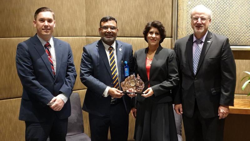
OGC and SSSI Working Together to Enhance the Capacity of Spatial Professionals Across Australia
Mr Simon Callaghan, Dr Zaffar Sadiq Mohamed-Ghouse, Dr Nadine Alameh and Mr Mark Reichardt (left to right)
-
Announcement
OGC seeks public comment on Geospatial Coverages Data Cube Community Practice Document
By documenting real-world community practices behind Geospatial Data Cubes the document aims to promote coordination and common terminology that could lead to federated Geospatial Data...
-
Announcement
OGC seeks public comment on draft charter for new Geopose Standards Working Group
The Geopose SWG will work towards a standard that will provide an interoperable way to express, record, and share the location, position, and orientation of...
-
Announcement
OGC requests public comment on draft charter for new ‘OGC API – Catalogues’ Standards Working Group
The purpose of this Standards Working Group is to develop a new version of the OGC Catalogue Service standard for the World Wide Web.OGC Chief...
-
Announcement
OGC invites you to the Disasters Resilience Pilot Demonstration Event
Getting the Right Information to the Right Person at the Right TimeThe Open Geospatial Consortium (OGC) invites anyone who provides and/or uses geospatial data or...
-
Announcement
OGC seeks public comment on Symbology Conceptual Core Model (SymCore)
The Open Geospatial Consortium (OGC) seeks public comment on the candidate Symbology Conceptual Core Model (SymCore).The Symbology Conceptual Core Model (SymCore) is the basis for...
-
Announcement
OGC Calls for Participation in its 3D IoT Platform for Smart Cities Pilot
The Pilot will focus on two scenarios: real-time monitoring of indoor occupancy; and real-time monitoring of micro-dust air pollutants.The Open Geospatial Consortium (OGC) invites interested...
-
Announcement
OGC invites you to its CityGML Challenge
Help to create visualization tools that support CityGML 3 and you could land a £5,000 cash prizeThe Open Geospatial Consortium (OGC), Ordnance Survey (OS), and...
-
Announcement
OGC and RTCA Announce Signing of Memorandum of Understanding
The Open Geospatial Consortium (OGC) and RTCA, Inc. are pleased to announce the signing of a memorandum of understanding (MOU) to collaborate in promoting the...
-
Announcement
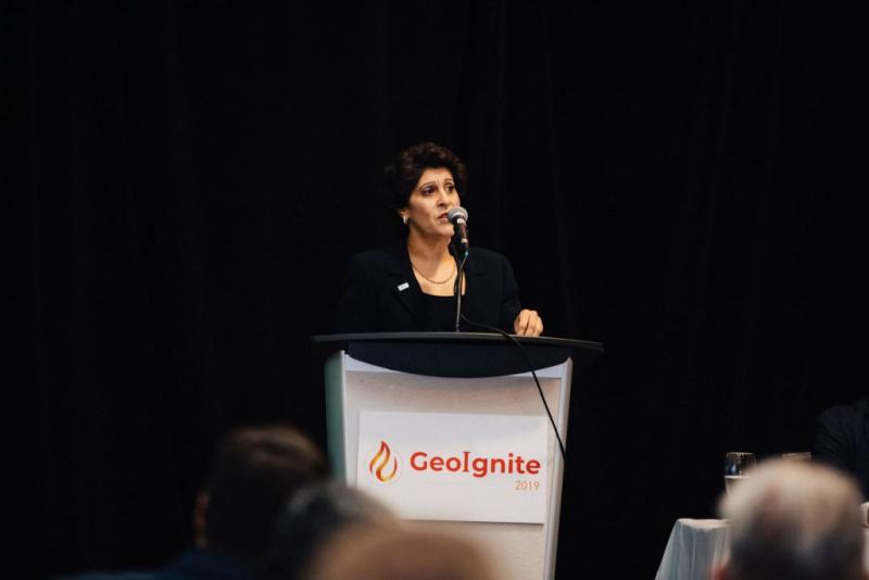
OGC’s Dr. Nadine Alameh receives GeoIgnite’s inaugural ‘Diversity in Leadership’ award
‘
-
Announcement
New BDLT DWG will build understanding of the importance of, and requirements for, geospatial standardization within these revolutionary, disruptive technologiesThe Open Geospatial Consortium (OGC) announces...
-
Announcement
OGC seeks public comment on major revision to OGC Abstract Specification Topic 0 – Overview
Abstract Specification Topic 0 - Overview.
-
Announcement
OGC seeks public comment on candidate Sensor Model Language (SensorML) v2.1 standard
The Open Geospatial Consortium (OGC) seeks public comment on the candidate Sensor Model Language (SensorML) v2.1 standard.Sensor model images are useful because they contain geospatial...
-
Announcement
OGC seeks public comment on update to GeoTIFF standard
Minor revision to GeoTIFF enables the use of newer coordinate reference systems and aligns it with OGC’s standardization process.The Open Geospatial Consortium (OGC) seeks public...
-
Announcement
OGC publishes Engineering Reports and Videos documenting successful Vector Tiles Pilot
Vector Tiles are an efficient way to package geographic data into roughly-square shaped tiles with many benefits, including fast loading and flexible styling.The Open Geospatial...
-
Announcement
OGC calls for Sponsors of a major Innovation Initiative, Testbed 16
OGC Testbeds work toward solving critical interoperability problems affecting location-based technologiesThe Open Geospatial Consortium (OGC) has issued a call for sponsors for its latest innovative...
-
Announcement
OGC invites developers to participate in the CityGML Hackathon
The Open Geospatial Consortium (OGC) invites interested developers to the OGC CityGML Hackathon, to be held in London on 11-12 June, 2019.In this hackathon, participants...
-
Announcement
OGC publishes results from its Testbed-14 Innovation Initiative
They describe prototypes developed by Testbed-14’s participating technology providers, and provide a clear vision on potential new or enhanced OGC standards.As with all Testbeds, the...
-
Announcement
OGC invites developers to the OGC API Hackathon
The Open Geospatial Consortium (OGC) invites interested developers to the OGC API Hackathon, held in London on June 20 & 21, 2019.The template will be...
-
Announcement
The Open Geospatial Consortium (OGC) invites interested members & non-members to solicit proposals and participate in the combined OGC Disaster Resilience Pilot (DRP-2019) & GEOSS...
-
Announcement
OGC invites you to participate in its SCIRA Smart Cities Public Safety Interoperability Pilot
The Open Geospatial Consortium (OGC) invites interested members & non-members to submit a proposal to participate in the SCIRA Public Safety Interoperability Pilot and receive...
-
Announcement
OGC invites you to a rail-themed Integrated Digital Built Environment (IDBE) Workshop
The Open Geospatial Consortium (OGC) and buildingSMART International (bSI) invite you to the next IDBE workshop on Monday, 1st April, 2019 in Heerbrugg, Switzerland.IDBE (Integrated...
-
Announcement
OGC invites you to participate in its Open Routing API Pilot 2019
The goal of the Open Routing API Pilot 2019 is to develop an API that allows requesting routes from different providers in a coherent, standardized...
-
Announcement
OGC invites you to its ‘Mixed Reality to the Edge’ Workshop this April in Tampa, FL
Visionary experts from Defense, Utilities, First Responders, and more will lead panels concerning the automation of workflows that bring 3D/4D geospatial content to users at...
-
Announcement
OGC invites you to participate in its Maritime Limits and Boundaries Pilot
Pilot will advance an implementation model, architecture, and prototypes for sharing Maritime Limits and Boundaries information.The Open Geospatial Consortium (OGC) invites interested members & non-members...
-
Announcement
The Open Geospatial Consortium (OGC) seeks public comment on the draft Charter for a proposed Blockchain and Distributed Ledger Technologies (BDLT) Domain Working Group (DWG).The...
-
Announcement
SELFIE aims to create a standards-based method to publish and use linked data thats compatible with current web development/W3C best practicesThe Open Geospatial Consortium (OGC)...
-
Announcement
OGC requests public comment on draft charter for new Portrayal Domain Working Group
The Portrayal DWG is being established to maintain consistency in the portrayal of geospatial data across a host of new technologies, including 3D, gaming &...
-
Announcement
OGC adopts 3D Tiles as Community Standard
3D Tiles Community Standard is designed for streaming massive heterogeneous 3D geospatial datasets for visualizationThe membership of the Open Geospatial Consortium (OGC) has approved the...
-
Announcement
OGC invites you to participate in its UML-to-GML Application Schema Initiative (UGAS-2019)
Initiative aims to enhance the automated conversion of UML models to OWLThe Open Geospatial Consortium (OGC) invites interested members & non-members to participate in OGC’s...
-
Announcement
OGC Announces Open Invitation to Tender for Testbed-15 ESA Threads
This part of the Testbed-15 solicitation allows interested and eligible parties to join those Testbed-15 activities that are sponsored by ESAThe Open Geospatial Consortium (OGC)...
-
Announcement
The Open Geospatial Consortium (OGC) proudly announces new Consortium leadership, effective 1 March 2019.“The Board of Directors is excited to announce the OGC leadership”, said...
-
Announcement
OGC Calls for Speakers for its Marine Summit in Singapore
Image copyright United Kingdom Hydrographic OfficeThe Open Geospatial Consortium (OGC) is calling for speakers for the 1-day OGC Marine Summit, which will be held in...
-
Announcement
RFI responses will be used to further advance the guidance provided by the DHS S&T Next Generation First Responder Handbook.OGC and DHS seek information on...
-
Announcement
OGC Seeks Public Comment on GroundwaterML v2.3 Candidate Standard
The Open Geospatial Consortium (OGC) seeks public comment on an updated version of the ‘OGC WaterML 2: Part 4 – GroundWaterML 2 (GWML2)’ candidate standard.The...
-
Announcement
OGC Calls for Participation in Major Innovation Testbed (Testbed-15)
The Open Geospatial Consortium (OGC) invites interested organizations to respond to the Call for Participation (CFP) for OGC’s Testbed-15 Innovation Initiative.Participants’ prototype solutions will implement...
-
Announcement
Request for Information: “Mixed Reality to the Edge” Concept Development Study
Study will explore the convergence of real world data with virtual 3d/4d environments for mobile and disconnected users.Standards enable governments, non-governmental organizations, private industry, and...
-
Announcement
OGC Announces its 110th Technical and Planning Committee Meeting, to be held in Singapore
The Open Geospatial Consortium (OGC) invites you to attend its 110th Technical and Planning Committee Meeting, which will be sponsored by the Singapore Land Authority...
-
Announcement
OGC invites you to its CDB Vector Data in GeoPackage Interoperability Experiment
Participants in this IE will have the opportunity to explore one or more design alternatives using Geopackage to encode vector data in their own CDB...
-
Announcement
OGC appoints Kumar Navulur and Frank Suykens to Board of Directors
The Open Geospatial Consortium (OGC) has announced the appointment of Kumar Navulur (left) and Frank Suykens (right) to its Board of Directors.Navulur and Dr. Suykens...
-
Announcement
At the InterGEO event in Frankfurt, Germany, the Open Geospatial Consortium (OGC) and the World Geospatial Industry Council (WGIC) signed a Memorandum of Understanding (MoU)...
-
Announcement
Mark Reichardt Receives Special Edition of OGC Gardels Award
Congratulations to outgoing President & CEO, Mark Reichardt, awarded a special edition of the Gardel’s Award in recognition of his years of commitment to, leadership...
-
Announcement
The Open Geospatial Consortium (OGC) is seeking public comment on the candidate PipelineML Conceptual and Encoding Model Standard (PipelineML).The standard is a deliverable of the...
-
Announcement
Disasters Pilot will benefit all disaster stakeholders through improved access to the expanding sphere of online disaster-related geographic information.The Open Geospatial Consortium (OGC) is seeking...
-
Announcement
2nd Energy & Utilities Summit will examine the role of OGC standards in support of Smart Energy Utilities, Smart Energy Communities, and Smart Energy Networks.The...
-
Announcement
OGC seeks public comment on adoption of two jointly developed OGC/W3C standards
OGC/W3C Time Ontology in OWL (OWL-Time) and Semantic Sensor Network (SSN) Ontology standards were prepared by the Spatial Data on the Web Working Group and...
-
Announcement
Open Geospatial Consortium announces HERE Technologies has joined OGC as a Principal Member
As Principal Member, HERE will help to explore market and technology trends to drive standards for the development of interoperable location servicesThe Open Geospatial Consortium...
-
Announcement
OGC announces a Request for Information on Marine Concept Development Study
The Open Geospatial Consortium (OGC) is requesting information to help shape the Marine Spatial Data Infrastructure Concept Development Study (MSDI- CDS), which will assess the...
-
Announcement
Open Geospatial Consortium and Natural Resources Canada partner on Geospatial Innovation
Additionally, NRCan will now participate in final approval decisions for all OGC standards and nominations to the Board of Directors.www.nrcan.gc.caNRCan has been a key proponent...
-
Announcement
OGC seeks public comment on Symbology Conceptual Core Model
SCCM aims to offer a consistent approach to specifying data portrayal and symbology rules that will increase consistency between mapsThe Open Geospatial Consortium (OGC) seeks...
-
Announcement
Sensor model images are useful because they contain geospatial information that is lost upon processing into rectified ‘map’ images.The 2.1 revision adds support for referenceable...
-
Announcement
Further, OGC will adopt published Khronos standards as part of the OGC Standards Baseline where it believes their inclusion to be appropriate, or where Khronos...
-
Announcement
New edition is aligned with the coordinate reference systems described in ISO 19111:2018, including dynamic geodetic reference frames, three-dimensional projected coordinate reference systems, datum ensembles,...
-
Announcement
OGC seeks public comment on Hierarchical Data Format Version 5 (HDF5) Core Standard
The Open Geospatial Consortium (OGC) seeks public comment on the candidate Hierarchical Data Format Version 5 (HDF5) Core Standard.Hierarchical Data Format Version 5 (HDF5) is...
-
Announcement
Joan Masó receives OGC’s 2018 Gardels Award
Congratulations to Joan Masó from Universitat Autònoma de Barcelona (CREAF), awarded the 2018 Gardels Award for being ‘the hardest working OGC member out there.’Joan Masó...
-
Announcement
OGC invites you to the Marine SDI (MDSI) Concept Development Study Workshop in Washington, DC
Workshop will shape and inform the Study as well as future OGC activities regarding Marine Spatial Data Infrastructures.The Open Geospatial Consortium (OGC) invites you to...
-
Announcement
New DWG will aim to improve interoperability of geospatial data in Artificial Intelligence, Deep Learning, and Machine Learning applicationsThe Open Geospatial Consortium (OGC) seeks public...
-
Announcement
OGC Seeks public comment on GeoPackage Related Tables Extension
The Open Geospatial Consortium (OGC) seeks public comment on the GeoPackage Related Tables Extension.The GeoPackage Related Tables Extension (RTE) defines the rules and requirements for...
-
Announcement
OGC Seeks Public Comment on MetOcean profile and extensions to WCS 2.1
Extension to and Profile for WCS 2.1 will enable MetOcean community to efficiently query and access required data contained in datacubes.The Open Geospatial Consortium (OGC)...
-
Announcement
The Open Geospatial Consortium (OGC) and the Simulation Interoperability Standards Organization (SISO) have signed a Memorandum of Understanding (MoU) to promote collaboration in the Modeling...
-
Announcement
OGC announces the creation of a new Domain Working Group for Interoperable Simulation and Gaming
New OGC Working Group has the goal of evaluating how standards will enable the modeling, simulation, and gaming communities to mutually benefit from ongoing technological...
-
Announcement
OGC Calls for Participation in Vector Tiles Pilot
OGC Vector Tiles Pilot will create extensions for use in OGC Web Services, GeoPackage, and supply a conceptual abstract model that can be used across...
-
Announcement
OGC seeks public comment on proposed Statistical Domain Working Group
New OGC DWG seeks to identify how geospatial and statistical standards can support the integration of geospatial information into the statistical system.The Open Geospatial Consortium...
-
Announcement
OGC Seeks Public Comment on new version of OpenSearch for Earth Observation Suite of Standards
Revision to OpenSearch extension for Earth Observation related searches includes two new encodings of the extension model using GeoJSON and JSON-LD.The Open Geospatial Consortium (OGC)...
-
Announcement
OGC Seeks Public Comment on WFS 3.0 Candidate Standard
The Open Geospatial Consortium (OGC) seeks public comment on the latest version of the Web Feature Service standard: WFS 3.0.An OGC Web Feature Service (WFS)...
-
Announcement
OGC Seeks Public Comment on 3D Tiles Candidate Community Standard
3D Tiles Community Standard is designed for streaming massive heterogeneous 3D geospatial datasets for visualizationThe Open Geospatial Consortium (OGC) seeks public comment on the 3D...
-
Announcement
OGC seeks public comment on Part 1 of the Features and Geometries Candidate Standard
The Open Geospatial Consortium (OGC) seeks public comment on Part 1 of the Features and Geometry candidate standard.The Features and Geometries candidate standard provides the...
-
Announcement
OGC seeks public comment on Tile Matrix Set Candidate Standard
The Open Geospatial Consortium (OGC) seeks public comment on the Tile Matrix Set candidate standard.A Tile Matrix Set defines a tile indexing pyramidal system to...
-
Announcement
OGC calls for participation its Borehole & Associated Data Interoperability Experiment
The Borehole IE will define a domain-neutral semantic for a general concept of boreholeThe Open Geospatial Consortium (OGC) invites interested members & non-members alike to...
-
Announcement
OGC calls for participation in its first Citizen Science Interoperability Experiment
The Open Geospatial Consortium (OGC) announces a Call for Participation in its first Citizen Science Interoperability Experiment (CitSciIE).Further, the number of citizen science projects is...
-
Announcement
OGC Calls for Participation in its Indoor Mapping and Navigation Pilot
The Indoor Mapping and Navigation Pilot will create and advance solutions to complex geospatial challenges related to indoor mapping and navigation for first responders.The Open...
-
Announcement
OGC Invites you to the Disasters CDS Workshop at the NOAA Auditorium, Silver Spring, MD
Workshop will shape future activities to be led by OGC regarding disaster preparedness & response, and will inform potential Disaster Spatial Data Infrastructures (SDI).The Open...
-
Announcement
OGC calls for participation in its Underground Infrastructure Pilot Project MUDDI ETL-Plugfest
ETL-Plugfest will test and improve the Model for Underground Data Definition and Integration (MUDDI) using real-world data and integration scenarios as part of OGC’s Underground...
-
Announcement
OGC announces creation of regional Canada Forum on Geospatial Standards
Members of the Canadian geomatics community have chartered the ‘Canada Forum on Geospatial Standards’ as a venue for collaboration on geospatial standardisation activitiesThe Open Geospatial...
-
Announcement
OGC seeks public comment on new Earth Observation Exploitation Platform Domain Working Group
New OGC Working Group has the goal of defining a standards-based framework for cloud-based access to and analysis of EO data.The Open Geospatial Consortium (OGC)...
-
Announcement
OGC seeks public comment on new Interoperable Simulation and Gaming Domain Working Group
New OGC Working Group has the goal of evaluating how standards will enable the modeling, simulation, and gaming communities to mutually benefit from ongoing technological...
-
Announcement
OGC announced as official partner of Earth Challenge 2020, a Citizen Science Initiative
The Open Geospatial Consortium (OGC) is proud to announce that is an official partner of Earth Challenge 2020, a citizen science initiative that will mark...
-
Announcement
OGC calls for Sponsors of a major Innovation Initiative, Testbed 15
OGC’s 15th Testbed will use current technology trends to improve the way geospatial information is accessed and sharedThe Open Geospatial Consortium (OGC) has issued a...
-
Announcement
OGC Calls for Sponsors for Maritime Limits and Boundaries Pilot
Pilot will further an implementation model, architecture, and prototypes for sharing Maritime Limits and Boundaries information.The Open Geospatial Consortium (OGC) has issued a call for...
-
Announcement
OGC Seeks Public Comment on update to Abstract Specification Topic 2: Referencing By Coordinates
The Open Geospatial Consortium (OGC) seeks public comment on the third edition of the Abstract Specification Topic 2: Referencing By Coordinates.The document was prepared by...
-
Announcement
OGC invites you to the Disasters CDS Workshop at NASA Ames
Workshop will shape future activities to be led by OGC regarding disaster preparedness & response, and to inform potential Disaster Spatial Data Infrastructures (SDI).The Open...
-
Announcement
Open Geospatial Consortium announces the European Space Agency’s upgrade to Strategic Membership
ESA will also participate in final approval decisions for all OGC standards and nominations to the Board of Directors.Earth Observation information is vital to decision...
-
Announcement
OGC seeks public comment on version 1.1 of CDB standard
The Open Geospatial Consortium (OGC) seeks comments on the candidate CDB version 1.1 standard.CDB version 1.1 is a minor revision and is fully backwards compatible...
-
Announcement
Two longest-serving OGC board members have announced their retirement; new appointment brings expertise in AI, machine learning, and other relevant technologiesThe Open Geospatial Consortium (OGC)...
-
Announcement
OGC requests responses to a survey regarding potential Professional Certification program
OGC is considering implementing a certification program to confirm individual’s competency in OGC standardsThe Open Geospatial Consortium (OGC) is considering developing a Professional Certification program.The...
-
Announcement
‘WaterML 2: Part 3 - Surface Hydrology Features’ standard forms the third part of the OGC WaterML 2 suite of standards that groups water-related OGC...
-
Announcement
Open Geospatial Standards track at ISPRS Technical Commission IV Symposium 2018
The call for papers for the 2018 Symposium, including the Open Geospatial Standards track, is now openThe Open Geospatial Consortium (OGC) is excited to announce...
-
Announcement
OGC publishes Testbed 13 Engineering Reports
Engineering Reports document the outcomes of Testbed 13, including new interoperability prototypes and potential OGC standards.The Open Geospatial Consortium (OGC) has released 24 Engineering Reports,...
-
Announcement
OGC joins ApacheCon as Community Partner and Geospatial Track lead
Call for papers for presentations outlining Apache projects that include geospatial data and processing closes 30th MarchThe Open Geospatial Consortium (OGC) has become an ApacheCon...
-
Announcement
OGC seeks public comment on Web Services Security Candidate Standard
Security Standard allows the hosting of OGC Web Services (OWS) over HTTPS as well as the implementation of Information AssuranceThe Open Geospatial Consortium (OGC) seeks...
-
Announcement
OGC requests information to guide Disasters Interoperability Concept Development Study
RFI aims to gain understanding of the potential of a Disaster SDI in serving local, national, regional, and international stakeholders.The Open Geospatial Consortium (OGC) requests...
-
Announcement
OGC seeks public comment on GML in JPEG 2000 (GMLJP2) v2.1 Candidate Encoding Standard
New revision of encoding standard allows geospatial content (GML) to be added to JPEG 2000 images and other gridded coverage data.The Open Geospatial Consortium (OGC)...
-
Announcement
The Open Geospatial Consortium (OGC) seeks public comment on the OGC SensorThings API, Part 2 - Tasking Core Candidate Standard.The OGC SensorThings API is a...
-
Announcement
OGC seeks public comment on Web Coverage Service (WCS) 2.1 Candidate Standard
Updated WCS 2.1 Standard will simplify access to spatio-temporal ‘big datacubes’The Open Geospatial Consortium (OGC) seeks public comment on the Web Coverage Service (WCS) 2.1...
-
Announcement
OGC Announces Earth Observation Exploitation Platform Hackathon 2018
Hackathon will test the readiness of new, interoperable cloud-deployment architectures for processing of Earth Observation dataThe Open Geospatial Consortium (OGC) is calling for participation in...
-
Announcement
OGC Requesting Responses to its Portrayal Concept Development Study
This new OGC CDS is the first step in improving the way that geospatial data is visually represented in web mapsThe Open Geospatial Consortium (OGC)...
-
Announcement
OGC Announces Disasters Interoperability Concept Development Study
The Open Geospatial Consortium (OGC) has announced the Disasters Interoperability Concept Development Study (CDS).The OGC is inviting anyone who provides and/or uses geospatial data or...
-
Announcement
The Open Geospatial Consortium (OGC®) invites interested organizations to respond to Part 2 of the OGC Testbed 14 Call for Participation.Part 2 concerns the European...
-
Announcement
OGC is seeking sponsors for Phase 2 of its Future Cities Pilot Project
The Open Geospatial Consortium (OGC) is seeking interested Sponsors to define the challenges for Phase 2 of the successful Future Cities Pilot Project.About the OGC...
-
Announcement
OGC Calls for Participation in Major Innovation Testbed (Testbed 14)
OGC’s 14th Testbed aims to explore new levels of interoperable geospatial data processing using core Web principlesThe Open Geospatial Consortium (OGC) invites interested organizations to...
-
Announcement
Data Model Development led by Fund for the City of New York advances OGC’s Underground Pilot Project
The utility data models that are being developed through the OGC Innovation Program include water, sewer, gas, electric, telecommunications, district heating, and transit.This effort is...
-
Announcement
OGC seeks public comment on CDB Multi-spectral Imagery Extension
The Open Geospatial Consortium (OGC) is seeking public comment on its candidate CDB Multi-spectral Imagery Extension standard.The Multi-Spectral Imagery extension defines how to encode and...
-
Announcement
OGC Calls for Sponsors for Augmented Reality Pilot Project
Joint OGC and W3C Pilot project will propose standards to unite Augmented Reality, Web, and Geospatial technologies.(Image from Wikitude)The Open Geospatial Consortium (OGC), and the...
-
Announcement
OGCs 105th Technical & Planning Committee Meeting: Environment and Agritech focus
New Zealand’s first OGC TC/PC meeting will follow the ISO/TC 211 meeting in Wellington and be bookended by environmental data and agricultural data summits.Open Geospatial...
-
Announcement
OGC Calls for Participation in its ‘Geospatial to the Edge’ Interoperability Plugfest
OGC Plugfest will advance, test, and validate the interoperability of geospatial software that implements specific profiles of open standards.The Open Geospatial Consortium (OGC) is calling...
-
Announcement
OGC invites you to its Testbed 13 Demonstration Event
The Open Geospatial Consortium (OGC®) invites members and the public to attend the OGC Testbed 13 demonstration of the outcomes of its latest Innovation Program...
-
Announcement
OGC seeks public comment on TimeseriesML 1.2 Candidate Standard
The Open Geospatial Consortium (OGC) seeks public comment on the TimeseriesML 1.2 Candidate Standard.Through the use of existing OGC standards, TimeseriesML 1.2 aims at being...
-
Announcement
OGC supports American Geographical Society’s 2017 Fall Symposium, Geography 2050
The Open Geospatial Consortium (OGC) and symposium partners the American Geographical Society (AGS), GEO, and USGIF will present the AGS Fall Symposium, Geography 2050: The...
-
Announcement
OGC announces a new standard that improves the way information is referenced to the earth
The membership of the Open Geospatial Consortium (OGC®) has approved the Discrete Global Grid System (DGGS) as OGC Abstract Specification - Topic 21 [OGC 15-104r5].The...
-
Announcement
OGC Announces New 3D Portrayal Service Standard
The membership of the Open Geospatial Consortium (OGC®) has approved the 3D Portrayal Service (3DPS) 1.0 standard.Viewing 3D geospatial content from diverse sources has just...
-
Announcement
Marie-Françoise Voidrot receives OGC’s Gardels Award
At the September meeting of the Open Geospatial Consortium (OGC®) Technical Committee in Southampton, UK, Marie-Françoise Voidrot received the OGC’s prestigious Kenneth D. Gardels Award.The...
-
Announcement
OGC approves Community Standard for streaming 3D Content
The standard is referred to as the OGC Indexed 3D Scene Layer (I3S) and the Scene Layer Package Format (SLPK) Specification.These standards are released as...
-
Announcement
OGC seeks public comment on proposed Geocoding API Standards Working Group
The Open Geospatial Consortium (OGC®) is requesting comments on the draft charter for an OGC Geocoding API Standards Working Group (SWG).The Geocoding API SWG aims...
-
Announcement
The Open Geospatial Consortium (OGC®) is calling for sponsors of a pilot project that will implement and demonstrate the sharing of information concerning underground infrastructure.The...
-
Announcement
OGC recognizes the IJIS Institute with Distinguished Member Award
The Open Geospatial Consortium (OGC®) is pleased to announce that the IJIS Institute has been awarded OGC’s Distinguished Member Award, and Steve Ambrosini a Lifetime...
-
Announcement
The Open Geospatial Consortium (OGC®) announces a Call for Participation (CFP) in the OGC GeoPackage (GPKG) Related Tables Extension Interoperability Experiment (GPKG-RTE IE).Compusult has proposed...
-
Announcement
The Open Geospatial Consortium (OGC®) seeks public comment on the candidate GeoPackage Extension for Tiled Gridded Coverage Data standard.‘GeoPackage Extension for Tiled Gridded Coverage Data’...
-
Announcement
The Open Geospatial Consortium (OGC®) announces a Call for Participation in a simulated disaster response exercise that will take place in Buenos Aires, Argentina on...
-
Announcement
Open Geospatial Consortium announces Leidos’ upgrade to Principal Membership
The Open Geospatial Consortium (OGC®) is pleased to announce that Leidos has raised its membership level from Technical to Principal Level.Leidos will also participate in...
-
Announcement
OGC publishes results of international Arctic Spatial Data Pilot
The Open Geospatial Consortium (OGC®) is pleased to announce the publication of results from the Arctic Spatial Data Pilot (Arctic SDP).The Arctic SDP, an 18...
-
Announcement
Open Geospatial Consortium announces Geoscience Australia as its newest Principal Member
The Open Geospatial Consortium (OGC®) is pleased to announce that Geoscience Australia has raised its membership level from Technical to Principal Level.Geoscience Australia has been...
-
Announcement
Open Geospatial Consortium announces Dassault Systèmes has joined OGC as a Principal Member
The Open Geospatial Consortium (OGC®) is pleased to announce that Dassault Systèmes has joined the OGC as a Principal Member.Principal Members also participate in final...
-
Announcement
OGC is calling for sponsors for an innovative interoperability initiative, Testbed 14
The Open Geospatial Consortium (OGC®) has issued a call for sponsors for an innovative interoperability initiative, Testbed 14.The OGC Innovation Program provides a venue to...
-
Announcement
OGC invites you to its Environmental Linked Feature Interoperability Experiment: ELFIE
The Open Geospatial Consortium (OGC®) invites interested members & non-members alike to participate in the OGC Environmental Linked Feature Interoperability Experiment (ELFIE).In recent years, environmental...
-
Announcement
The Open Geospatial Consortium (OGC®) is seeking public comment on its Web Coverage Service 2.0 Interface Standard - Earth Observation Application Profile 1.1.This OGC WCS...
-
Announcement
OGC seeks comment on candidate InfraGML Part 7 Land Division Standard
The Open Geospatial Consortium (OGC®) is seeking public comment on the candidate InfraGML 1.0: Part 7 – LandInfra Land Division - Encoding Standard.The candidate OGC...
-
Announcement
OGC seeks comment on proposed GeoScience Domain Working Group
The Open Geospatial Consortium (OGC®) seeks comments on the draft charter of a proposed GeoScience Domain Working Group (DWG).The GeoScience Domain Working Group aims to...
-
Announcement
OGC appoints Dr. Luis Bermudez to head OGC Innovation Program
The Open Geospatial Consortium (OGC®) announces Dr Luis Bermudez as the new Executive Director of its Innovation Program.Continuing OGC’s leadership in advancing geospatial information, OGC...
-
Announcement
The Open Geospatial Consortium (OGC®) is seeking public comment on the candidate standard GRIB2 Coverage, an Encoding Profile of the OGC Coverage Implementation Schema.The candidate...
-
Announcement
OGC requests public comment on proposed GeoRSS Community Standard
The Open Geospatial Consortium (OGC®) is requesting public comment on the proposed GeoRSS Community Standard.GeoRSS is the first OGC Community Standard to be released for...
-
Announcement
OGC requests public comment on proposed Indexed 3D Scene Layers (I3S) Community Standard
The Open Geospatial Consortium (OGC®) is requesting public comment on the proposed Indexed 3D Scene Layers Community Standard.Indexed 3D Scene Layers (I3S) was submitted by...
-
Announcement
OGC approves new standard for geological science data
The membership of the Open Geospatial Consortium (OGC®) has approved GeoSciML as an OGC Standard.The OGC GeoSciML Standard defines a model and encoding for geological...
-
Announcement
OGC announces kickoff of major innovation testbed – Testbed 13
The Open Geospatial Consortium (OGC®) has announced that the Kickoff Event for the Testbed 13 Innovation Initiative will be held on 4-6 April at USGS’...
-
Announcement
Moving Features Access defines location data access operations so that big data from moving features, such as people and vehicles, can be processed and analyzed...
-
Announcement
OGC seeks public comment on proposed Unmanned Systems Domain Working Group
The Open Geospatial Consortium (OGC®) seeks comments on the draft charter of a proposed Unmanned Systems Domain Working Group (UXS DWG).The UXS DWG is chartered...
-
Announcement
OGC calls for public review of proposed Common Object Model Container Standards Working Group
The Open Geospatial Consortium (OGC®) request comments on the draft charter for an OGC Common Object Model Container (COMC) Standards Working Group (SWG).The core philosophy...
-
Announcement
OGC is seeking information on Geospatial APIs
The Open Geospatial Consortium (OGC®) is looking for information on the existence of mapping and geospatial Application Programming Interfaces (APIs) as part of an OGC...
-
Announcement
OGC seeks public comment on new Abstract Specification Topic for Discrete Global Grid Systems (DGGS)
The Open Geospatial Consortium (OGC®) is requesting public comment on its Discrete Global Grid System (DGGS) Abstract Specification Topic.The OGC DGGS Abstract Specification supports the...
-
Announcement
OGC invites you to the Arctic Spatial Data Pilot demonstration
23 February 2017: The Open Geospatial Consortium (OGC®) invites members and the public to attend the OGC Arctic Spatial Data Pilot demonstration online or in-person...
-
Announcement
OGC is seeking data and services for Testbed 13’s mass migration scenario
OGC Testbed 13 participants will implement services, access data, and demonstrate capabilities using the services and data identified during this RFI.The overarching theme for Testbed...
-
Announcement
OGC invites expertise on underground maps and models
Any organization with an interest in underground infrastructure is invited to respond to the RFI before 15 March 2017.We have embarked on the formulation of...
-
Announcement
These funds, along with contributions from Ordnance Survey Great Britain and other contributors, will enable OGC to initiate the first of a three-phase project to...
-
Announcement
The Open Geospatial Consortium (OGC®) invites interested organizations to respond to Part 2 - ESA Thematic Exploitation Platform.The overall Testbed 13 Call for Participation (CFP)...
-
Announcement
OGC seeks public comment on candidate GeoPackage 1.2 standard
The Open Geospatial Consortium (OGC®) seeks public comment on its candidate GeoPackage 1.2 standard.Over the course of 2016, the GeoPackage Standards Working Group (SWG) made...
-
Announcement
OGC Calls for Participation in Major Innovation Testbed (Testbed 13)
For the most up to date details on the OGC Testbed 13 CFP please see the CFP page http://www.opengeospatial.org/standards/requests/154 **The Open Geospatial Consortium (OGC®) invites...
-
Announcement
OGC seeks public comment on OGC WaterML 2 – Part 3, Surface Hydrology Features Conceptual Model
The membership of the Open Geospatial Consortium (OGC®) seeks public comment on its WaterML 2 - Part 3, Surface Hydrology Features Conceptual Model.The OGC WaterML...
-
Announcement
OGC seeks public comment on candidate InfraGML encoding standards
The membership of the Open Geospatial Consortium (OGC®) seeks public comment on its candidate InfraGML standards.The candidate OGC InfraGML Encoding standards define the implementation-dependent, GML...
-
Announcement
OGC Calls for Participation in its Indian Interoperability Plugfest
26 December 2016: The Open Geospatial Consortium (OGC®) is calling to vendors doing business in India for participation in its latest Interoperability Plugfest.The Department of...
-
Announcement
The Open Geospatial Consortium (OGC®) seeks public comment on the OGC Coverage Implementation Schema (CIS) - ReferenceableGridCoverage Extension.This OGC Extension provides a set of native...
-
Announcement
OGC invites participation in Electromagnetic Spectrum Domain Working Group
28 November 2016 - The Open Geospatial Consortium (OGC®) is calling for participation in its newly established Electromagnetic Spectrum Domain Working Group (EM Spectrum DWG).After...
-
Announcement
OGC invites you to its Testbed 12 demonstration and exposition
The Open Geospatial Consortium (OGC®) is inviting members and the public to attend the OGC Testbed 12 demonstration and exposition of the technology developed during...
-
Announcement
The Open Geospatial Consortium (OGC®) is considering start of a new work item for a Community Standard: Indexed 3D Scene Layers (I3S).The Indexed 3D Scene...
-
Announcement
OGC Requests comments on proposed Quality of Service and Experience DWG
The Open Geospatial Consortium (OGC®) requests comments on the charter for a proposed Quality of Service and Experience (QoSE) Domain Working Group (DWG).Spatial data now...
-
Announcement
OGC approves Standard for use in the Modeling and Simulation World
The Open Geospatial Consortium (OGC®) membership has approved CDB as an OGC standard.The OGC CDB standard is based on and derived from an industry developed...
-
Announcement
OGC supports American Geographical Society’s 2016 Fall Symposium, Geography 2050
The Open Geospatial Consortium (OGC®) and symposium partners the American Geographical Society (AGS), the Earth Institute, GEO, and USGIF will present the 2016 AGS Fall...
-
Announcement
Stan Tillman receives OGC’s Gardels Award
At the September meeting of the Open Geospatial Consortium (OGC®) Technical Committee in Orlando, Florida, USA, Stan Tillman received the OGC’s prestigious Kenneth D. Gardels...
-
Announcement
OGC requests participation in its Land Administration DWG
The Open Geospatial Consortium (OGC®) is calling for public participation in its newly-established Land Administration Domain Working Group (Land Admin DWG).Worldwide, effective and efficient land...
-
Announcement
OGC publishes Testbed 12 Aviation Thread Engineering Reports
Members of the Open Geospatial Consortium (OGC®) recently approved the release of 7 draft public OGC Engineering Reports, products of the recently completed OGC Interoperability...
-
Announcement
OGC seeks public comment for candidate Moving Features Access Standard
The Open Geospatial Consortium (OGC®) seeks public comment on its candidate Moving Features Access Standard.The OGC currently maintains two Moving Features Encoding Standards for capturing...
-
Announcement
OGC is considering a proposed work item for 3D Tiles as a Community Standard
The Open Geospatial Consortium (OGC®) is considering start of a new work item for a Community Standard: 3D Tiles.3D Tiles is a publicly available open...
-
Announcement
The Open Geospatial Consortium (OGC®) invites you to attend its 100th Technical and Planning Committee Meeting, which will be sponsored by CAE and held at...
-
Announcement
The Open Geospatial Consortium (OGC®) seeks public comment on the draft OGC Spectrum Model Language Domain Working Group (SpectrumML DWG) Charter.The OGC SpectrumML Domain Working...
-
Announcement
Location Powers Workshop to advance Geospatial applications of Big Data
The Open Geospatial Consortium (OGC®) has announced its Location Powers: Big Data workshop, occurring on Tuesday 20th September in Orlando, Florida.The Location Powers: Big Data...
-
Announcement
OGC releases CityGML Quality Interoperability Experiment Engineering Report
The Open Geospatial Consortium (OGC®) has released the results of the CityGML Quality Interoperability Experiment (QIE) as a public Engineering Report.Carried out as a joint...
-
Announcement
OGC adopts SensorThings API Part 1: Sensing Standard
The Open Geospatial Consortium (OGC®) has adopted SensorThings API Part 1: Sensing as an official standard.The OGC SensorThings API provides an open, geospatially enabled way...
-
Announcement
OGC requests participation in its Citizen Science DWG
The Open Geospatial Consortium (OGC®) is calling for public participation in its newly-established Citizen Science Domain Working Group (Citizen Science DWG).As many citizen science projects...
-
Announcement
OGC requests participation in its Marine DWG
The Open Geospatial Consortium (OGC®) is calling for public participation in its newly-established Marine Domain Working Group (Marine DWG).The Marine DWG was established to address...
-
Announcement
OGC announces v3.0 of its Catalogue Services (CAT) Standard
The Open Geospatial Consortium (OGC®) announces the release of version 3.0 of the OGC Catalogue Services standard.Catalogue services support the ability to publish and search...
-
Announcement
OGC and SIBA sign Memorandum of Understanding
Further, SIBA will assist with local promotion and education regarding OGC standards in the Asia Pacific region, including advocating the use of OGC standards by...
-
Announcement
OGC requests comment on revision of its GWML2 specification
The Open Geospatial Consortium (OGC®) is requesting comments on the WaterML 2: Part 4 - GroundWaterML 2 (GWML2) candidate standard.The GWML2 standard is motivated by...
-
Announcement
OGCs 99th Technical and Planning Committee Meetings to be held 20-24 June in Dublin, Ireland
The Open Geospatial Consortium (OGC®) invites you to join us for our 99th Technical & Planning Committee (TC/PC) Meetings - to be hosted by University...
-
Announcement
OGC adopts WaterML2.0 Part 2 – Ratings, Gaugings and Sections Standard
The membership of the Open Geospatial Consortium (OGC®) has approved the WaterML2.0 Part 2 - Ratings, Gaugings and Sections Standard as an official OGC standard.The...
-
Announcement
OGC requests comment on charter for Land Administration Domain Working Group
Members of the Open Geospatial Consortium (OGC®) request comments on the draft charter for an OGC Land Administration Domain Working Group (DWG).Worldwide, effective and efficient...
-
Announcement
OGC requests comment on charter for Coordinate Reference System Standards Working Group
Members of the Open Geospatial Consortium (OGC®) request comments on the draft charter for an OGC Coordinate Reference System (CRS) Standards Working Group (SWG).The purpose...
-
Announcement
OGC seeks public comment on CDB Candidate Standard
This OGC Candidate Standard specifies an open format and encoding for the storage, access and modification of a representation of the natural and built environment...
-
Announcement
The Open Geospatial Consortium (OGC®) requests public comment on the update of OGC Abstract Specification Topic 11: Metadata from ISO 19115:2003 to ISO 19115:2014.The OGC...
-
Announcement
ASTM International and the Open Geospatial Consortium (OGC®) will collaborate on developing and disseminating standards, best practices, and other tools that support the growing geospatial...
-
Announcement
OGC announces successful completion of Incident Management Information Sharing IoT Pilot
8 March 2016: The Open Geospatial Consortium (OGC®) has announced the recent successful completion of the OGC Incident Management Information Sharing Internet of Things Pilot...
-
Announcement
Harris Corporation becomes a Principal Member of the Open Geospatial Consortium
The Open Geospatial Consortium (OGC®) is pleased to announce that long-time member Harris Corporation has raised its membership from Technical to Principal level.Further, in this...
-
Announcement
OGC seeks public comment on candidate OGC® Coverage Collection Extension
4 March 2016 - The membership of the Open Geospatial Consortium (OGC®) seeks public comment on the candidate OGC® Coverage Collection Extension Standard.The candidate OGC®...
-
Announcement
OGC announces Oil Spill Response Common Operating Picture recommended practice
As stated in the report, Responding to an oil spill requires access to and understanding of many types of information.Recent oil spills have provided lessons...
-
Announcement
OGC requests information to guide Arctic Spatial Data Pilot
24 February 2016 – The Open Geospatial Consortium (OGC®) requests information to help advance the “Arctic Spatial Data Pilot”.The Arctic Spatial Data Pilot is an...
-
Announcement
OGC® announces kickoff of major interoperability testbed – Testbed 12
At the March 2-4 Kickoff Event, Testbed 12 Sponsors and OGC Staff will present the interoperability requirements and objectives for the six Testbed 12 threads...
-
Announcement
OGC invites input to guide Point Cloud standards work
The Open Geospatial Consortium (OGC) Point Cloud Domain Working Group (Point Cloud DWG) formed late last year to assess the current state of standards and...
-
Announcement
OGC® calls for Proposals for a Future City Pilot Phase 1 project
By demonstrating capabilities employed in a holistic urban planning scenario, the Future Cities Pilot will show how cities can begin to reap the benefits.The BIM...
-
Announcement
01 February 2016 - The membership of the Open Geospatial Consortium (OGC®) seeks public comment on the candidate OGC® Land and Infrastructure Conceptual Model Standard...
-
Announcement
OGC announces simplified web mapping standard
25 January 2016 – The OGC announces that the OGC membership has adopted the The OGC® WMTS Simple Profile, which defines a simplified profile of...
-
Announcement
21 January 2016 - The Open Geospatial Consortium (OGC®), the Inlocation Alliance (ILA) and the i-locate Project invite you to contribute to a survey on...
-
Announcement
20 January 2016 - The membership of the Open Geospatial Consortium (OGC®) seeks public comment on the OGC Emergency and Disaster Management Information Framework Discussion...
-
Announcement
19 January 2016 – The W3C and OGC Spatial Data on the Web Working Group has published the First Public Working Draft of its Best...
-
Announcement
18 January 2016 - The membership of the Open Geospatial Consortium (OGC®) seeks public comment on the following two candidate standards: OGC Geospatial User Feedback...
-
Announcement
OGC® seeks public comment on a candidate standard that may replace legacy coordinate systems
The Open Geospatial Consortium (OGC) requests public comment on the OGC candidate Discrete Global Grid Systems (DGGS) Core Standard.The OGC DGGS candidate standard defines a...
-
Announcement
OGC announces new Arctic Spatial Data Infrastructure Project
4 January 2016 – The Open Geospatial Consortium (OGC®) announces a new OGC Interoperability Program project called the Arctic Spatial Data Infrastructure Standards and Communication...
-
Announcement
16 November 2015 – The Open Geospatial Consortium (OGC®) announces that there will be two separate submission deadlines and kickoff dates for “threads” of the...
-
Announcement
OGC® seeks participants for international GeoPackage Elevation Data Interoperability Experiment
The Open Geospatial Consortium (OGC) announces a Call for Participation (CFP) in the OGC GeoPackage (GPKG) Elevation Extension Interoperability Experiment (GPKG-EE IE).The OGC GeoPackage Standards...
-
Announcement
OGC publishes Testbed 11 Aviation Information Management Engineering Reports
4 November 2015 – The OGC Members recently approved release of 26 public OGC Engineering Reports, products of the recently completed OGC Interoperability Testbed 11.While...
-
Announcement
OGC and ASPRS to collaborate on geospatial standards, invite participation in Point Cloud work
2 November 2015 - The Open Geospatial Consortium (OGC) and the American Society for Photogrammetry and Remote Sensing (ASPRS) have agreed to work together more...
-
Announcement
OGC® Calls for Participation in Major Interoperability Testbed (Testbed 12)
The Open Geospatial Consortium (OGC®) has issued a Request for Quotations/Call for Participation (RFQ/CFP) in the OGC Testbed 12 Interoperability Testbed.Testbed 12 sponsors have documented...
-
Announcement
OGC® seeks comment on the OGC OWS Context GeoJSON Encoding Standard
The Open Geospatial Consortium (OGC®) seeks public comment on the OGC OWS Context GeoJSON Encoding candidate standard.The OGC Web Services Context Document standard (OWS Context)...
-
Announcement
The OGC requests comment on the OGC® OpenSearch Extension for Earth Observation Standard
7 October 2015 - The Open Geospatial Consortium (OGC®) is seeking comments on the OGC OpenSearch Extension for Earth Observation, a candidate OGC standard.This OpenSearch...
-
Announcement
OGC requests comment on Publish/Subscribe standards for geospatial data
Members of the Open Geospatial Consortium (OGC®) request comments on the candidate OGC Publish/Subscribe Core (PSC) 1.0 Interface Standard and the OGC Publish/Subscribe SOAP Binding...
-
Announcement
OGC requests participation in Point Cloud Domain Working Group
The Open Geospatial Consortium (OGC) is calling for public participation in its newly-established Point Cloud Domain Working Group (Point Cloud DWG).The purpose of the Point...
-
Announcement
OGC requests comment on charter for spatial services security standards working group
Members of the Open Geospatial Consortium (OGC®) request comments on the draft charter for an OGC Open Web Services (OWS) Common Security Standards Working Group...
-
Announcement
OGC requests comment on Discussion Papers extending access to 4D weather data collections
Members of the Open Geospatial Consortium (OGC®) request comments on a proposed OGC Discussion Paper A MetOcean Metadata Profile for WCS 2.0 and the supporting...
-
Announcement
OGC requests comment on standard model and encoding for timeseries data
Members of the Open Geospatial Consortium (OGC®) request comments on proposed OGC standards for the representation of observations as timeseries, that is, a sequence of...
-
Announcement
NRCan becomes a Principal Member of the Open Geospatial Consortium
The Open Geospatial Consortium (OGC®) is pleased to announce that Natural Resources Canada (NRCan) has raised its membership level from Technical level to Principal level.Led...
-
Announcement
OGC announces Common DataBase Best Practice
The Open Geospatial Consortium (OGC®) membership announces OGC’s approval of the OGC Common DataBase specification as an OGC Best Practice.This OGC Best Practice specifies an...
-
Announcement
OGC seeks input on GeoPackage extensions
23 July 2015 - The Open Geospatial Consortium (OGC®) GeoPackage Standards Working Group (SWG) seeks public input to guide their development and prioritization of new...
-
Announcement
OGC seeks sponsors for FutureCities Pilot
The FutureCities Pilot will bring together visionary sponsors to help define activities that meet cities spatial information requirements.Ordnance Survey, a Strategic Member of the OGC,...
-
Announcement
OGC® invites organizations to co-sponsor a major spatial interoperability testbed
The encodings and interfaces often become candidate OGC standards that are vetted, voted on and then adopted by the OGC membership as open international standards.The...
-
Announcement
Members of the Open Geospatial Consortium (OGC®) request comments on the OGC® Web Coverage Service 2.0 Interface Standard – JPEG2000/JPIP Coverage Encoding Extension – abbreviated...
-
Announcement
OGC seeks public comment on OGC Web Coverage Service – Transaction operation extension
The OGC membership seeks public comment on the candidate OGC® Web Coverage Service (WCS) - Transaction operation extension, version 2.0.The OGC Web Coverage Service (WCS)...
-
Announcement
OGC® adopts WPS 2.0 standard interface for accessing computational services via the Web
The Open Geospatial Consortium (OGC) membership has approved the OGC Web Processing Service (WPS) Version 2 Interface Standard.The OGC Web Processing Service (WPS) Version 2...
-
Announcement
OGC requests comment on draft charter for Hydrologic Features Standards Working Group
Members of the Open Geospatial Consortium (OGC®) request comments on the draft charter for an OGC Hydrologic Features (HY_Features) Standards Working Group (SWG).The purpose of...
-
Announcement
OGC seeks public comment on SensorThings API standard for Internet of Things
The OGC® membership seeks public comment on the candidate OGC SensorThings API Standard, Part 1.The OGC SensorThings API is a free and non-proprietary lightweight interface...
-
Announcement
OGC® adopts updated KML Earth browser standard – KML 2.3
The Open Geospatial Consortium (OGC®) announces that the OGC membership has approved the OGC KML 2.3 Standard.In early 2007, Google submitted KML to the Open...
-
Announcement
OGC requests comment on charter for Point Cloud Domain Working Group
Members of the Open Geospatial Consortium (OGC®) request comments on the draft charter for an OGC Point Cloud Domain Working Group (DWG).The Point Cloud DWG...
-
Announcement
Paul Scarponcini receives OGC’s Gardels Award
At the June meeting of the Open Geospatial Consortium (OGC(R)) Technical Committee in Boulder, Colorado, USA, Paul Scarponcini, PE, PhD received the OGCs prestigious Kenneth...
-
Announcement
Ordnance Survey becomes a Strategic Member of the Open Geospatial Consortium
The OGC is pleased to announce that Ordnance Survey (OS) has raised its Open Geospatial Consortium (OGC) membership level to become the first Strategic Member...
-
Announcement
OGC announces Geospatial/BIM/Indoor Location Workshop
18 May 2015 – The Open Geospatial Consortium (OGC®) announces a Geospatial/BIM/Indoor Location (“GIS BIM”) Workshop to be held at the UCAR/NCAR Center Green in...
-
Announcement
OGC announces Water Data Summit
15 May 2015 – The Open Geospatial Consortium (OGC®) announces a Water Data Summit to be held at the UCAR/NCAR Center Green in Boulder, Colorado...
-
Announcement
OGC issues GeoPackage corrigendum
12 May 2015 - The Open Geospatial Consortium (OGC®) has issued a corrigendum to correct minor flaws in the OGC GeoPackage (GPKG) Encoding Standard.GeoPackage was...
-
Announcement
OGC announces standard for concise description of Earth coordinate reference systems
5 May 2015 – The Open Geospatial Consortium (OGC®) membership has adopted the OGC Well-known Text (WKT) Representation of Coordinate Reference Systems Encoding Standard.The newly...
-
Announcement
OGC calls for participation in GeoSemantics Summit
30 April 2015 – On 3 June 2015, the Open Geospatial Consortium (OGC) GeoSemantics Domain Working Group will host a summit, GeoSemantics: Standards Intersect Ontologies.Well...
-
Announcement
OGC Calls for participation in major sensor IoT interoperability pilot project
The Open Geospatial Consortium (OGC®) has issued a Request for Quotations/Call for Participation (RFQ/CFP) in the OGC Incident Management Information Sharing Internet of Things Pilot...
-
Announcement
OGC® Compliance Overview – Guide for Software Acquisition white paper available
The OGC membership has approved “OGC Compliance Overview - Guide for Software Acquisition” as an official OGC white paper.This white paper provides an overview of...
-
Announcement
OGC seeks public comment on the OGC WaterML2.0: part 2 – Ratings, Gaugings and Sections Standard
9 April 2015 - The membership of the Open Geospatial Consortium (OGC®) seeks public comment on the candidate WaterML2.0 - part 2: Ratings, Gaugings and...
-
Announcement
OGC and ILA to Collaborate on Indoor Positioning
11 March 2015 – Two global organizations, the Open Geospatial Consortium (OGC) and the InLocation Alliance (ILA), have begun working together to advance indoor positioning...
-
Announcement
OGC Information Technology Standards for Sustainable Development white paper announced
The Open Geospatial Consortium (OGC®) membership has approved the OGC® Information Technology Standards for Sustainable Development white paper.This important document for environmental science, business and...
-
Announcement
OGC requests comment on charter for group developing a terrain modeling standard
Members of the Open Geospatial Consortium (OGC®) request comments on the draft charter for an OGC Common DataBase Standards Working Group.The proposed OGC Common DataBase...
-
Announcement
OGC® Smart Cities Spatial Information Framework white paper announced
The Open Geospatial Consortium (OGC®) membership has approved the OGC® Smart Cities Spatial Information Framework white paper.This paper addresses an open information technology standards framework...
-
Announcement
OGC® adopts ARML 2.0, new open standard encoding for sharing Augmented Reality data
The Open Geospatial Consortium (OGC) membership has approved the OGC® Augmented Reality Markup Language 2.0 Interface Standard (ARML 2.0).Augmented Reality (AR) content encoded in ARML...
-
Announcement
OGC adopts Moving Feature Encoding standard
17 February 2015 – The Open Geospatial Consortium (OGC®) membership has approved the OGC Moving Feature Encoding Model and Encoding as an official OGC standard.Many...
-
Announcement
OGC and OMA to Exhibit Together at Mobile World Congress 2015
The Open Geospatial Consortium (OGC) and the Open Mobile Alliance (OMA) today announced they will cooperate at Mobile World Congress in Barcelona, Spain, March 2-5,...
-
Announcement
Carl Reed to retire as OGCs CTO and Executive Director Standards Program
The Open Geospatial Consortium (OGC®) announces that on January 31 Carl Reed retired from his position as CTO and Executive Director Standards Program at the...
-
Announcement
GEO Announces Call for Participation in 8th GEOSS Pilot with OGC Leadership
30 January 2015 – The Group on Earth Observations (GEO) has announced a Call for Participation (CFP) in the 8th phase of the Global Earth...
-
Announcement
The Open Geospatial Consortium (OGC®) announces that it has adopted the OGC Unified Geo Data Reference Model For Law Enforcement and Public Safety as an...
-
Announcement
OGC seeks public comment on candidate 3D Portrayal Service Standard
28 January 2015 - The membership of the Open Geospatial Consortium (OGC®) seeks public comment on the candidate OGC 3D Portrayal Service (3DPS) Standard.Based on...
-
Announcement
OGC requests comment on LandInfra Conceptual Model
22 January 2015 - The Open Geospatial Consortium (OGC(R)) membership has issued a Request for Comments on the OGC LandInfra Conceptual Model.This document, the first...
-
Announcement
Scott Simmons to lead OGCs Standards Program
The Open Geospatial Consortium (OGC) announces that Scott Simmons will assume the role of Executive Director, Standards Program as Carl Reed leaves that position at...
-
Announcement
OGC requests scenarios for Crisis Management ICT Workshop
21 January 2015 - The OGC and Fraunhofer IOSB have organized the Geospatial ICT Support for Crisis Management and Response workshop at ISCRAM 2015.Risk and...
-
Announcement
OGC® adopts IndoorGML standard for encoding indoor navigation data
The Open Geospatial Consortium (OGC) membership has approved the OGC IndoorGML Encoding Standard.This OGC standard specifies an open abstract data model and XML schema for...
-
Announcement
Scott Serich appointed OGC Director, Interoperability Programs
The Open Geospatial Consortium (OGC®) announces that it has appointed Dr. Scott Serich as Director, Interoperability Programs.Dr. Serich will support OGC’s participation in the Project...
-
Announcement
OGC approves WaterML 2.0 Water Quality Best Practice
The Open Geospatial Consortium (OGC®) membership has approved the OGC WaterML 2.0 Water Quality (WaterML-WQ) document for publication as an OGC Best Practice.This OGC Best...
-
Announcement
W3C and OGC to Collaborate to Integrate Spatial Data on the Web
6 January 2015 — The W3C and the Open Geospatial Consortium (OGC) announced today a new collaboration to improve interoperability and integration of spatial data...
-
Announcement
OGC seeks public comment on KML 2.3 standard
19 December 2014 - The membership of the Open Geospatial Consortium (OGC®) seeks public comment on the candidate OGC KML 2.3 Standard.KML is an XML...
-
Announcement
Trimble becomes a Principal Member of the Open Geospatial Consortium
The Open Geospatial Consortium (OGC®) is pleased to announce that Trimble has raised its membership level from Technical Committee level to Principal level.As a Principal...
-
Announcement
OGC seeks comment on new working group focused on disseminating lightweight “datacubes”
20 November 2014 – The OGC seeks comment on the charter for a new OGC Standards Working Group (SWG) being formed to develop an OGC...
-
Announcement
The OGC adopts GML in JPEG 2000 (“GMLJP2”) Encoding Standard Version 2
19 November 2014 - The Open Geospatial Consortium (OGC®) has adopted the OGC GML in JPEG 2000 Encoding Standard (Part 1 - Core) (GMLJP2) version...
-
Announcement
OGC Supports European Data Modelling Workshop
National Mapping and Cadastral Agencies and other spatial data infrastructure (SDI) content providers are facing increasing demand for making well documented data in known data...
-
Announcement
17 November 2014 - The membership of the Open Geospatial Consortium (OGC®) seeks public comment on the candidate Earth Observation Metadata Profile of the OGC...
-
Announcement
OGC and GEO announce joint session on GEOSS in Asia: The Next 10 years
November 13, 2014 - Join the Group on Earth Observations (GEO), the Open Geospatial Consortium (OGC) and invited speakers at a special joint session scheduled...
-
Announcement
OGC announces KML 2.2 Test Suite
The Open Geospatial Consortium (OGC®) has announced that the OGC Members approved the KML 2.2 validator as part of the official OGC Compliance Testing Facility.The...
-
Announcement
OGC adopts OGC Sensor Observation Service 2.0 Hydrology Profile Best Practice
The OGC membership has adopted the OGC Sensor Observation Service 2.0 Hydrology Profile as an OGC Best Practice.The OGC Sensor Observation Service (SOS) 2.0 Interface...
-
Announcement
OGC helps develop UN’s geospatial standards guide for UN Member States
The Committee recognized the important work done by three international standards development organisations: the Open Geospatial Consortium (OGC), Technical Committee 211 of the International Organization...
-
Announcement
OGC hires Dr. Ingo Simonis to lead geomatic sciences initiatives
The Open Geospatial Consortium (OGC®) announces that it has appointed Dr. Ingo Simonis to the position of Director, Interoperability Programs and Science.As Director, Interoperability Programs...
-
Announcement
OGC President Mark Reichardt to Deliver Geospatial Keynote at GEO-Energy Summit
The Open Geospatial Consortium – Mark Reichardt, president of the Open Geospatial Consortium, will deliver the geospatial keynote address at the GEO-Energy Summit and Educational...
-
Announcement
OGC appoints Dr. Terry Idol as Executive Director, Interoperability Program
The Open Geospatial Consortium (OGC®) announces that it has appointed Dr. Terry Idol as Executive Director, Interoperability Program.Continuing OGC’s leadership in advancing geospatial information, OGC...
-
Announcement
The OGC seeks comments on candidate OGC Web Processing Service 2.0 Standard
The Open Geospatial Consortium (OGCⓇ) membership seeks public comment on the candidate OGC Web Processing Service (WPS) Version 2.0 Interface Standard.The OGC Web Processing Service...
-
Announcement
22 August 2014 – The Technical and Planning Committees have approved release of RESTful encoding of OGC® Sensor Planning Service for Earth Observation Satellite Tasking...
-
Announcement
OGC announces new Urban Planning Domain Working Group
An OGC Urban Planning Domain Working Group (SWG) has been chartered to define the role for OGC standards and related activities within the Urban Planning...
-
Announcement
OGC announces Big Data Domain Working Group
13 August 2014 – At the recent OGC meetings in Geneva, members of the OGC formed an OGC Big Data Domain Working Group.This OGC domain...
-
Announcement
OGC publishes Testbed 10 Open Mobility location standards Engineering Reports
19 public Engineering Reports resulted from the Open Geospatial Consortiums (OGC®) OGC Testbed 10, the most recent in the OGCs yearly series of major geospatial...
-
Announcement
OGC calls for comment on candidate Moving Feature Encoding standard
24 July 2014 – The OGC seeks public comment on a candidate OGC® Moving Feature Encoding Standard.Part I of this candidate standard provides a standard...
-
Announcement
OGC publishes Testbed 10 Cross-Community Interoperability Engineering Reports
23 July 2014 – 24 public Engineering Reports resulted from the Open Geospatial Consortiums (OGC®) recently completed OGC Interoperability Testbed 10 (OWS-10), the most recent...
-
Announcement
OGC calls for public comment on candidate standard for encoding coverages in JPEG2000
21 July 2014 – The Open Geospatial Consortium (OGC®) membership seeks public comment on the candidate OGC GML Application Schema - Coverages – JPEG2000 Coverage...
-
Announcement
OGC announces new Geospatial User Feedback Standards Working Group
Members of the Open Geospatial Consortium (OGC®) have formed an OGC Geospatial User Feedback Standards Working Group (SWG).The OGC Geospatial User Feedback SWG charter can...
-
Announcement
OGC’s final call for sponsors of major location information interoperability testbed
The OGC is now planning OGC Testbed 11.The next Sponsors Planning meeting for OGC Testbed 11 is planned for 1100 EDT US on 16 July...
-
Announcement
OGC seeks comment on charter for new Urban Planning Domain Working Group
An OGC Urban Planning Domain Working Group (SWG) is being chartered to define the role for OGC standards and related activities within the Urban Planning...
-
Announcement
The OGC adopts Open Modelling Interface (OpenMI) Standard
1 July 2014 – The Open Geospatial Consortium (OGC®) membership has approved the Open Modelling Interface Standard Version 2 (OpenMI) as an OGC standard.By publishing...
-
Announcement
OGC publishes Testbed 10 Aviation Information Management Engineering Reports
This information may be useful to implementors of OGC standards, but OGC Engineering Reports do not represent official OGC positions.The OGC Public Engineering Reports web...
-
Announcement
The OGC calls for participation in a CityGML Data Quality Interoperability Experiment
The OGC calls for participation in an interoperability experiment to define data quality requirements for virtual 3D city models encoded in CityGML.An increasing range of...
-
Announcement
OGC 3DIM honors Gerhard Gröger with OGC 3D award
During the 3rd OGC™ 3D Summit in Geneva, Switzerland, the second OGC 3DIM Award was given to Gerhard Gröger from the University of Bonn, Germany.He...
-
Announcement
The OGC seeks comments on candidate OGC Web Map Tile Service Simple Profile
The Open Geospatial Consortium (OGC™) membership seeks public comment on the candidate OGC Web Map Tile Service Simple Profile of the OGC Web Map Tile...
-
Announcement
The mission of the workgroup is real property data content standardization and seeks to foster the adoption of standards published by the organizations.Quality data as...
-
Announcement
The OGC seeks comment on charter for GeoTIFF Standards Working Group
The Open Geospatial Consortium (OGC®) seeks comments on the charter for a new GeoTIFF Standards Working Group (SWG).The OGC GeoTIFF SWG formation and process are...
-
Announcement
New OGC Domain Working Group for Mobile Location Services
The Open Geospatial Consortium (OGC®) membership has formed the Mobile Location Services Domain Working Group (DWG).The kick-off meeting of the new Mobile Location Services DWG...
-
Announcement
The Open Geospatial Consortium (OGC®) membership seeks public comment on the Unified Geo-Data Reference Model for Law Enforcement and Public Safety (LEAPS) Services, with the...
-
Announcement
US Intelligence Foundation promotes value of OGC standards at international conference
The Virginia-based United States Geospatial Intelligence Foundation (USGIF) recognized industry innovation and employment of OGC standards to nearly 4,000 international attendees at the 2014 GEOINT...
-
Announcement
OGC Seeks Public Comment on Catalogue Service Version 3.0 candidate standard
22 May 2014 - The Open Geospatial Consortium (OGC®) Membership seeks public comment on a new version of the OGC Catalogue Service interface standard.Therefore, the...
-
Announcement
OGC encourages attendance at AGILE & COBWEB Workshop – Citizen Science, Quality and Standards
The AGILE & COBWEB Workshop - Citizen Science, Quality and Standards will be held June 3, 2014 in Castellón, Spain in conjunction with the AGILE...
-
Announcement
The OGC calls for presentations and invites public to the Third OGC 3D Summit
The primary topic for this year’s 3D Summit is State of the Art in 3D, with particular focus on the following aspects:1.This 3D Summit will...
-
Announcement
The OGC® seeks public participation in Development of CityGML 3.0
In 2008 it was adopted by the OGC membership as an international OGC standard.Active participation in the CityGML 3.0 development process does not require OGC...
-
Announcement
The OGC seeks comments on charter for PipelineML Working Group
16 May 2014 – The Open Geospatial Consortium (OGC®) seeks comments on the charter for a new OGC PipelineML Standards Working Group (DWG).The initiators encourage...
-
Announcement
Pitney Bowes becomes a Principal Member of the Open Geospatial Consortium
The Open Geospatial Consortium (OGC®) is pleased to announce that Pitney Bowes Inc. has raised its membership level from Technical Committee level to Principal level.Pitney...
-
Announcement
The OGC adopts I15 standard providing ebRIM extension to OGC Catalog Services Interface Standard
12 May 2014 - The Open Geospatial Consortium (OGC®) membership as adopted the OGC standard, OGC I15 (ISO19115 Metadata) Extension Package of CS-W ebRIM Profile...
-
Announcement
Register for the OGC Testbed 10 Webinars!
5 May 2014 – The Open Geospatial Consortium (OGC) invites software developers, location service providers, spatial analytics experts, system architects and information system managers to...
-
Announcement
The OGC seeks comments on charter for Big Data Domain Working Group
24 April 2014 – The Open Geospatial Consortium (OGC®) seeks comments on the charter for a new OGC Big Data Domain Working Group (DWG).The widespread...
-
Announcement
OGC calls for participation in USGS Interoperability Assessment Virtual Exercise
USGS data services get over 1 million hits per day.As part of the USGS Interoperability Assessment Initiative, the OGC and its members are evaluating the...
-
Announcement
The OGC® adopts OGC Geo and Time Extensions Standard for OpenSearch
24 April 2014 - The Open Geospatial Consortium (OGC®) Members approved OGC OpenSearch Geo and Time Extensions as an OGC standard.OGC OpenSearch Geo and Time...
-
Announcement
OGC Requests Host for Compliance Tools Infrastructure
To support the Open Geospatial Consortium (OGC) Compliance Program, the OGC is accepting proposals from organizations that are able to host the OGC Compliance Tools...
-
Announcement
Ordnance Survey becomes a Principal Member of the Open Geospatial Consortium
24 March 2014 - The Open Geospatial Consortium (OGC®) is pleased to announce that Ordnance Survey has raised its membership level from Technical Committee level...
-
Announcement
OGC announces new Discrete Global Grid Systems Standards Working Group
The Open Geospatial Consortium (OGC®) announces the formation of a new OGC Technical Committee Standards Working Group (SWG).The purpose of this SWG will be to...
-
Announcement
OGC PRESS RELEASEContact: info [at] opengeospatial.org4 March 2014 - The Open Geospatial Consortium (OGC®) Academic Summit 2014 will be held 15-16 September 2014 at the...
-
Announcement
OGC invites government information system managers to a GeoPackage Webinar
25 February 2014 – The Open Geospatial Consortium (OGC) and Directions Media invite government information system managers to attend a free webinar on the new...
-
Announcement
The OGC approves SensorML 2.0, advanced standard for Internet of Things
24 February 2014 - The Open Geospatial Consortium (OGC®) has approved the OGC Sensor Model Language (SensorML) 2.0 Encoding Standard.SensorML 2.0 provides a standard encoding...
-
Announcement
The OGC invites comments on the candidate IndoorGML navigation standard
19 February 2014 - The Open Geospatial Consortium (OGC®) IndoorGML Standards Working Group seeks public comments on the candidate OGC IndoorGML Encoding Standard.The candidate OGC...
-
Announcement
18 February 2014 – The Open Geospatial Consortium (OGC) invites Mobile World Congress attendees to attend workshops on the new OGC GeoPackage Service Interface Standard,...
-
Announcement
The OGC seeks comment on revised GML in JPEG 2000 Encoding Standard
17 February 2014 - The Open Geospatial Consortium (OGC®) seeks comment on the candidate GML in JPEG 2000 Encoding Standard version 2.This geospatial data encoding...
-
Announcement
OGC adopts important GeoPackage Standard for Mobile
13 February 2014 - The Open Geospatial Consortium (OGC®) has adopted the OGC GeoPackage (GPKG) Encoding Standard.The GeoPackage standard will make it much easier to...
-
Announcement
OGC, Layar, Metaio and Wikitude invite Mobile World Congress attendees to AR Interoperability Demo
Layar, Metaio and Wikitude, the largest AR platform providers, have cooperated to make it easy for AR content to be shared across their technology platforms.The...
-
Announcement
Small cells can be used to support location services in a range of indoor locations including: navigation in airports, retail unit location in shopping centers...
-
Announcement
OGC Announces Winners of OGC Student App Challenge, sponsored by Google
For his WalkYourPlace app, Mr. Poorazizi has won a Nexus Tablet donated by Google.Also, Mr. Poorazizi’s university, University of Calgary, will receive a two-year free...
-
Announcement
The OGC forms working group to draft Point of Interest (POI) encoding standard
This group will develop a candidate POI encoding specification for possible adoption by the OGC membership as an OGC Standard.Considering the ubiquitous need for POI...
-
Announcement
OGC announces new Compliance Fee Schedule
5 December 2013 - The Open Geospatial Consortium (OGC®) announced a new, simplified compliance fee schedule.The new fee schedule will take effect 1 March 2014.The...
-
Announcement
The USGIF M&S Working Group Demo is part of the I/ITSEC 2013 Modeling, Simulation & Training Conference, to be held this year in Orlando, Florida.The...
-
Announcement
OGC and PODS Association plan to enhance PODS pipeline management standard
The Open Geospatial Consortium and the PODS Association, Inc. (“PODS”), have signed a liaison agreement to provide value for the members of each organization.Janet Sinclair,...
-
Announcement
The OGC publishes new conformance tests for existing OGC standards
The OGC Compliance Program provides an online free testing facility to check for proper implementation of the standards, and a process for certification of products...
-
Announcement
The OGC adopts OWS Context Conceptual Model and ATOM Encoding Standards
18 November 2013 - The Open Geospatial Consortium (OGC®) membership has adopted the OGC OWS Context Conceptual Model and the associated OGC OWS Context ATOM...
-
Announcement
The Open Geospatial Consortium (OGC) invites participation in the Ratings, Gaugings and Cross-Sections Interoperability Experiment (RGSIE), which will further develop and test the current OGC...
-
Announcement
The OGC requests comment on the candidate standard, OGC® OpenSearch Geo and Time Extensions
13 November 2013 - The Open Geospatial Consortium (OGC®) is seeking comments on the candidate standard, OGC® OpenSearch Geo and Time Extensions.This document extends the...
-
Announcement
The OGC forms working group to advance spatial standards in health domain
4 November 2013 – At the Open Geospatial Consortium (OGC®) Technical Committee plenary meeting on 26 September, the Technical Committee approved the charter for a...
-
Announcement
31 October 2013 - The Open Geospatial Consortium (OGC®) is seeking comments on the candidate OGC standard, OGC I15 (ISO19115 Metadata) Extension Package of the...
-
Announcement
The OGC Seeks Comments on Candidate GeoPackage Encoding Standard
30 October 2013 - The Open Geospatial Consortium (OGC®) seeks final “last-call” public comments on the current draft of the candidate OGC GeoPackage (GPKG) Encoding...
-
Announcement
The OGC requests comment on proposal to update ISO 19107:2003 Geographic information – Spatial
The OGC requests comment on proposal to update ISO 19107:2003 Geographic information – Spatial29 October 2013 - The Open Geospatial Consortium (OGC®) is seeking comments...
-
Announcement
Mark Reichardt, president and CEO of the Open Geospatial Consortium, explained, Location and the communications infrastructure are linked in emergency management, cyber security, Building Information...
-
Announcement
OGC partners with TECTERRA in hosting geospatial investment event
10 October 2013 - The OGC and TECTERRA invite resource industry professionals to the Opening Doors, Connecting Business event, Tuesday, 5 November 2013.TECTERRA, along with...
-
Announcement
DigitalGlobe becomes a Principal Member of the Open Geospatial Consortium
The Open Geospatial Consortium (OGC®) is pleased to announce that DigitalGlobe has raised its membership level from Technical Committee level to Principal level.“The work the...
-
Announcement
2 October 2013 - The Open Geospatial Consortium (OGC®) is seeking comments on the candidate OGC standard, Geographic Information – Well Known Text (WKT) for...
-
Announcement
Jeff de La Beaujardière Receives OGC’s Gardels Award
At the September meeting of the Open Geospatial Consortium (OGC(R)) in Frascati, Italy, Jeff de La Beaujardière, PhD, received the OGCs prestigious Kenneth D. Gardels...
-
Announcement
26 September 2013 – Members of the Open Geospatial Consortium (OGC) and the United States Geospatial Intelligence Foundation (USGIF) Modeling and Simulation (M&S) Working Group...
-
Announcement
OGC Calls for input on Aircraft Access to SWIM (AAtS) Standards Harmonization
RFI Information:The RFI is available at http://www.opengeospatial.org/standards/requests/111.The FAA’s Aircraft Access to SWIM (AAtS) initiative is in a preliminary stage of requirements development and standards identification.The...
-
Announcement
The purpose of UKIAP 2013 is to advance the interoperability of geospatial products and services based on OGC standards within the UK geospatial information (GI)...
-
Announcement
The OGC invites review of location data standards in energy and utility worlds
12 Sep 2013 – The OGC Energy & Utilities Domain Working Group (E&U DWG) invites you to attend presentations on Location Communication in Energy and...
-
Announcement
The sponsors of the OGC Geo4NIEM Initiative:Program Manager – Information Sharing Environment (PM-ISE)National Information Exchange Model – Program Management Office (NIEM PMO)and the Open Geospatial...
-
Announcement
22 August, 2013 - The Open Geospatial Consortium (OGC®) is seeking comments on the candidate OGC Web Coverage Service (WCS) Interface Standard Interpolation Extension.The OGC...
-
Announcement
The OGC requests comment on the Scaling Extension to the OGC Web Coverage Service Interface Standard
20 August 2013 - The Open Geospatial Consortium (OGC®) is seeking comments on the candidate OGC Web Coverage Service (WCS) Interface Standard Scaling Extension.The OGC...
-
Announcement
8 August 2013 - The Open Geospatial Consortium (OGC®) is seeking comments on the candidate OGC Web Coverage Service (WCS) Interface Standard Range Subsetting Extension.The...
-
Announcement
The Location Based Marketing Association (The LBMA) and the Open Geospatial Consortium (OGC) recently signed a liaison agreement.Mark Reichardt, president and CEO of the Open...
-
Announcement
23 July 2013 - The Open Geospatial Consortium (OGC®) is seeking comments on the candidate OGC Web Coverage Service (WCS) Interface Standard Processing Extension.The OGC...
-
Announcement
The Open Geospatial Consortium (OGC®) is seeking comments on the charter [ available at: https://portal.ogc.org/files/54744 ] for a proposed OGC Standards Working Group (SWG).The new...
-
Announcement
OGC Calls for Participation in Major Interoperability Testbed
The Open Geospatial Consortium (OGC®) has issued a Request for Quotations/Call for Participation (RFQ/CFP) to solicit proposals in response to requirements for the OGC Testbed...
-
Announcement
The OGC requests comments on the OWS Context Encoding Standard
9 July 2013 - The Open Geospatial Consortium (OGC®) is seeking comments on the candidate OGC OWS Context Encoding Standard.This standard is comprised of three...
-
Announcement
For Immediate Release27 June 2013 - The Open Geospatial Consortium (OGC®) announced a call for public comment on the OGC WaterML 2.0 – part 2:...
-
Announcement
30 May 2013 - The Open Geospatial Consortium (OGC®) seeks public input on the draft charter of a proposed Standards Working Group (SWG) that will...
-
Announcement
OGC , SIG 3D, and TUM announce workshop to gather CityGML requirements
29 May 2013 - The OGC CityGML SWG, the SIG 3D, and Technische Universität München will host a joint international workshop to gather requirements to...
-
Announcement
The OGC calls for comments on the Open Modelling Interface (OpenMI) standard
2 May 2013 - The Open Geospatial Consortium (OGC®) and the OpenMI Association (OA) have announced a call for public comment on the Open Modelling...
-
Announcement
OGC Announces Student Map App Challenge, sponsored by Google
10 April 2013 - The Open Geospatial Consortium (OGC®) announces the OGC Student Map App Challenge, sponsored by Google, an OGC Principal Member.The Student Map...
-
Announcement
5 April 2013 - The Open Geospatial Consortium (OGC®) announced a call for public comment on the OGC Web Coverage Service (WCS) Coordinate Reference System...
-
Announcement
OGC announces creation of Middle East and North Africa Forum
In response to the growing interest and use of OGC standards throughout the region, the Ministry of the Interior hosted the OGC TC PC meetings...
-
Announcement
OGC requests implementations for compliance testing, offers free licenses
The Open Geospatial Consortium (OGC) requests implementations of the following OGC standards to be used in validating beta compliance tests:Specification Version OGC Geography Markup Language...
-
Announcement
20 March 2013 - The Open Geospatial Consortium (OGC®) has adopted as an official OGC Best Practice a document titled, OGC EO Product Collection, Service...
-
Announcement
OGC and buildingSMART International host Civil & Land Development Summit 2013
The Open Geospatial Consortium (OGC®) Land Development Domain Working Group in partnership with buildingSMART International http://www.buildingsmart.org/ will host the inaugural Civil Summit as part of...
-
Announcement
The OGC invites comment on GeoSciML 4.0 Standards Working Group charter
The Open Geospatial Consortium (OGC®) announced the formation of a new OGC Technical Committee Standards Working Group (SWG).The purpose of this SWG is to progress...
-
Announcement
The SI Organization, Inc. becomes a Principal Member of the Open Geospatial Consortium
The Open Geospatial Consortium (OGC®) is pleased to announce that The SI Organization, Inc. (the SI) has raised its membership level from Technical Committee level...
-
Announcement
The OGC Approves Semantic annotations in OGC standards Best Practice Document
25 February 2013 - The Open Geospatial Consortium (OGC®) has adopted Semantic annotations in OGC standards as an OGC Best Practice.OGC standards provide standard ways...
-
Announcement
GEO Announces Call for Participation in 6th GEOSS Pilot with OGC Leadership
20 February 2013 - The Group on Earth Observations (GEO) has announced a Call for Participation (CFP) in the 6th phase of the Global Earth...
-
Announcement
The OGC Forms Moving Features Standards Working Group
The Open Geospatial Consortium (OGC®) announced the formation of the Moving Features Standards Working Group (Moving Features SWG).This group is chartered to develop a candidate...
-
Announcement
OGC Approves Climate and Forecast (CF) extension to NetCDF Core data model standard
14 February 2013 - The Open Geospatial Consortium (OGC®) membership has adopted the OGC CF-netCDF Data Model extension to the existing OGC Network Common Data...
-
Announcement
The Open Geospatial Consortium (OGC®) has issued a Request for Quotations/Call for Participation (RFQ/CFP) to solicit proposals in response to requirements for the OGC Geo4NIEM...
-
Announcement
The OGC announces Call for Participation in MilOps Geospatial Interoperability Experiment
31 January 2013 - The Open Geospatial Consortium (OGC) has announced a Call for Participation (CFP) in the OGC MilOps Geospatial Interoperability Experiment (MOGIE).The purpose...
-
Announcement
The OGC requests comments on the OWS Context Conceptual Model and ATOM Extension candidate standards
18 January 2013 - The Open Geospatial Consortium (OGC®) is seeking comments on the OGC OWS Context Conceptual Model and the associated ATOM Extension document...
-
Announcement
Lockheed Martin awarded the OGC’s Distinguished Member Award
At the January meeting of the Open Geospatial Consortium (OGC(R)) in Redlands, California, Lockheed Martin, a global security and aerospace company, was awarded the Open...
-
Announcement
The OGC announces Wide Area Motion Imagery Best Practices Document
14 January 2013 - The Open Geospatial Consortium (OGC®) has adopted the OGC Wide Area Motion Imagery Best Practices Document (WAMI BP) as an official...
-
Announcement
The OGC Seeks Comments on Candidate GeoPackage Standard
8 January 2013 - The Open Geospatial Consortium (OGC®) seeks public comments on the current draft of the candidate OGC GeoPackage (GPKG) Standard.The GPKG Standards...
-
Announcement
OGC Calls for Sponsors for 10th Major Interoperability Testbed
The Open Geospatial Consortium (OGC®) has issued a call for sponsors of the 10th annual OGC Web Services Testbed (OWS-10) (http://www.opengeospatial.org/projects/initiatives/ows-10).Sponsors of OGC testbeds provide...
-
Announcement
The OGC Invites Public to Final Demonstration of Major Testbed Activity
The Open Geospatial Consortium (OGC®) invites interested organizations to attend the January 15 OWS-9 Testbed Demonstration and Exhibition.OGC testbeds, pilot projects and interoperability experiments are...
-
Announcement
The OGC Forms 3D Portrayal Standards Working Group
The Open Geospatial Consortium (OGC®) announced the formation of the 3D Portrayal Standards Working group (3D Portrayal SWG).This group is chartered to progress the Candidate...
-
Announcement
OGC WaterML Standard Recommended for Adoption as Joint WMO/ISO Standard
10 December 2012 - The Open Geospatial Consortium (OGC®) reports an important milestone in efforts to have the OGC WaterML 2.0 Encoding Standard adopted by...
-
Announcement
OGC and CRCSI working together to make data widely available
The Australian Cooperative Research Center for Spatial Information (CRCSI) has joined forces with the Open Geospatial Consortium (OGC) through the signing of a memorandum of...
-
Announcement
The OGC Seeks Participants for Ground Water Interoperability Experiment
The Open Geospatial Consortium (OGC) invites participation in a Groundwater Interoperability Experiment (GWIE2).Participants will then prepare an engineering report with the intent to develop it...
-
Announcement
The OGC seeks comments on candidate Augmented Reality Markup Language (ARML 2.0) standard
2 November 2012 - The Open Geospatial Consortium (OGC®) seeks public comment on the candidate OGC Augmented Reality Markup Language (ARML) 2.0 Encoding Standard.ARML 2.0...
-
Announcement
The OGC seeks comment on candidate SensorML 2.0 standard
5 November 2012 - The Open Geospatial Consortium (OGC®) seeks public comment on the candidate OGC SensorML 2.0 Encoding Standard.In addition, SensorML 2.0 includes the...
-
Announcement
The OGC seeks comment on GML Coverages GeoTIFF extension and WCS 2.0 GeoTIFF extension standard
30 October 2012 - The Open Geospatial Consortium (OGC®) seeks comment on a GeoTIFF extension to the OGC GML Coverages (GMLCOV) 1.0 Standard and on...
-
Announcement
Denise McKenzie Joins OGC as Executive Director, Marketing and Communications
29 October 2012The Open Geospatial Consortium (OGC®) announces that it has appointed Denise McKenzie as Executive Director, Marketing and Communications.Working with OGC staff, board, membership...
-
Announcement
OGC Seeks Comments on NIL Extension to Geography Markup Language (GML)
The Open Geospatial Consortium (OGC®) seeks public comment on the candidate GML-NIL profile of the OGC Geography Markup Language (GML) Encoding standard.The candidate OGC GML-NIL...
-
Announcement
The OGC Forms GeoPackage Standards Working Group
The Open Geospatial Consortium (OGC®) announced the formation of a new OGC® Technical Committee Standards Working Group (SWG) to advance the candidate OGC GeoPackage (GPKG)...
-
Announcement
OGC completes 3D Portrayal Interoperability Experiment
19 September 2012 - The Open Geospatial Consortium (OGC®) has completed the 3D Portrayal Interoperability Experiment (3DPIE).The 3DPIE was designed to test and demonstrate different...
-
Announcement
OGC Joins ITU, participates in Joint Coordination Activity on Internet of Things
The OGC has previously participated in the ITU Joint Coordination Activity on Internet of Things (JCA-IoT).In the future, the OGC will consider participation in the...
-
Announcement
OGC seeks comments on Land Information Domain Working Group charter
13 September 2012 - The Open Geospatial Consortium (OGC®) announces the formation of a new OGC Land Information Domain Working Group (Land Info DWG) to...
-
Announcement
Trevor Taylor joins the OGC as Director, Services for the Americas
Trevor Taylor joins the OGC as Director, Services for the Americas4 September 2012 - The Open Geospatial Consortium (OGC®) has appointed Trevor Taylor to the...
-
Announcement
OGC hires Lew Leinenweber and Bart de Lathouwer to fill key technical positions
21 August 2012 - The Open Geospatial Consortium (OGC®) has appointed both Lew Leinenweber and Bart de Lathouwer to the position of Director, Interoperability Programs.These...
-
Announcement
The OGC forms Energy & Utilities Domain Working Group
20 August 2012 - The Open Geospatial Consortium (OGC®) announced the formation of a new OGC Energy & Utilities Domain Working Group (E&U DWG) to...
-
Announcement
Attend the OGC North American Forum Open Standards Technology Exposition!
Attend the OGC North American Forum Open Standards Technology Exposition!13 August 2012The North American Forum (NAF) of the Open Geospatial Consortium (OGC) is organizing the...
-
Announcement
OGC Calls for Participation in Climatology-Hydrology Information Sharing Pilot
3 August 2012 - The Open Geospatial Consortium (OGC®) has issued a Request for Quotations/Call for Participation (RFQ/CFP) to solicit proposals in response to requirements...
-
Announcement
OGC Seeks Comments on GeoServices REST API Candidate Standard
The Open Geospatial Consortium (OGC®) seeks public comment on the candidate OGC GeoServices REST API standard.The GeoServices REST Application Programming Interface (API) provides a standard...
-
Announcement
The OGC Forms Sensor Web for IoT Standards Working Group
The OGC members invite the public to comment on the Sensor Web for IoT SWG charter (https://portal.ogc.org/files/49608) and will consider comments received before 10 August...
-
Announcement
OGC Requests Web Map Service Clients (WMS) Reference Implementations
5 July 2012 - To support compliance testing, the Open Geospatial Consortium (OGC) requests reference implementations for client software that implements the OGC Web Map...
-
Announcement
David Wesloh Receives OGC’s Gardels Award
David Wesloh Receives OGC’s Gardels AwardWayland, MA, USA, 26 June 2012.At the June meeting of the Open Geospatial Consortium (OGC(R)) in Exeter, England, David Wesloh...
-
Announcement
OGC and AGI host Interoperability Day 2012 – Open Government and Open Standards
The Open Geospatial Consortium (OGC) and the Association of Geographic Information (AGI) have joined forces to offer European organizations the chance to learn more about...
-
Announcement
OGC Seeks Comments on NetCDF Enhanced Data Model Extension Standard
June 1, 2012 - The Open Geospatial Consortium (OGC®) membership seeks comments on an OGC candidate standard, the Network Common Data Form (NetCDF) NetCDF Enhanced...
-
Announcement
OGC Energy & Utilities Group Invites Smart Grid Standards Presentations
This meeting, focused on Smart Grid standards, will be part of the upcoming OGC Technical Committee meeting to be held June 18-21 in Exeter.This group...
-
Announcement
OGC Sensor Observation Service (SOS) Standard Version 2.0 Adopted
The Open Geospatial Consortium (OGC®) membership has adopted the OGC Sensor Observation Service (SOS) Interface Standard Version 2.0.The OGC® Sensor Observation Service Interface Standard (SOS)...
-
Announcement
OGC City Geography Markup Language v 2.0 Adopted
- The Open Geospatial Consortium (OGC®) membership has adopted Version 2.0 of the OGC City Geography Markup Language (CityGML) Encoding Standard (http://www.opengeospatial.org/standards/citygml).CityGML is a community...
-
Announcement
Ministry of the Interior, represented by Abu Dhabi Police GIS Center for Security, has become a Principal Member of the OGC to chair a new,...
-
Announcement
The OGC Names Dr. Jinsoo You Director of Asian Services
The Open Geospatial Consortium (OGC®) announced that Dr. Jinsoo You has become the first Director of Asian Services for the OGC.He will promote awareness and...
-
Announcement
Aviation Community Adoption of Open Geospatial Standards Progresses
22 February 2012 - The global aviation community is moving forward on the adoption of an international framework of standards that enable communication in a...
-
Announcement
OGC Calls for Participation in Major Interoperability Testbed – Feb ’12
The Open Geospatial Consortium (OGC®) has issued a Request for Quotations/Call for Participation (RFQ/CFP) to solicit proposals in response to requirements for the OGC Web...
-
Announcement
OGC Announces Smart Grid Location Standards Ad Hoc Meeting
20 February 2012 - The Open Geospatial Consortium (OGC®) invites Smart Grid professionals to a Smart Grid Location Standards Meeting to be held on March...
-
Announcement
Synaptitude Consulting Joins the OGC to Advance Smart Grid Location Standards
The two organizations plan to leverage their strengths to enable Smart Grid stakeholders to make the best possible use of the Smart Grids ubiquitous location...
-
Announcement
OGC PUCK standard enables `plug and work` sensor networks
30 January 2012 - The Open Geospatial Consortium (OGC®) membership has voted to adopt the candidate OGC PUCK Protocol Standard (http://www.opengeospatial.org/standards/puck ).PUCK addresses these challenges...
-
Announcement
OGC Membership Approves Open GeoSMS Standard for Encoding Location in Short Message Service (SMS)
26 January 2012 - The Open Geospatial Consortium (OGC®) membership has voted to adopt the candidate OGC Open GeoSMS Standard as an official OGC standard.The...
-
Announcement
PIXIA Becomes a Principal Member of the Open Geospatial Consortium
The Open Geospatial Consortium (OGC®) is pleased to announce that PIXIA Corporation has raised their OGC membership level to Principal Member.PIXIA has been an active...
-
Announcement
The OGC Forms IndoorGML Indoor Location Standards Working Group
The Open Geospatial Consortium (OGC®) announced the formation of a new OGC Technical Committee Standards Working Group (SWG) to advance the candidate OGC IndoorGML Standard.This...
-
Announcement
The OGC seeks comment on WaterML 2.0 Hydrologic Time Series Encoding Standard
17 January 2012 - The Open Geospatial Consortium (OGC®) seeks public comment on the candidate OGC WaterML 2.0: part 1 – Time Series Encoding Standard.WaterML...
-
Announcement
Jeffrey K. Harris Elected Chairman of the OGC Board of Directors
The Open Geospatial Consortium (OGC(R)) Board of Directors has unanimously elected The Honorable Jeffrey K. Harris as Chairman of the Board of the Open Geospatial...
-
Announcement
The OGC seeks comment on GeoSynchronization Best Practices
7 December 2011 - The Open Geospatial Consortium (OGC®) seeks public comment on the candidate OGC GeoSynchronization Best Practices Document.Frequently, geospatial content providers must collaborate...
-
Announcement
The OGC seeks comment on Gazetteer Best Practices
7 December 2011 - The Open Geospatial Consortium (OGC®) seeks public comment on the candidate OGC Gazetteer Best Practices Document.This candidate OGC best practice describes...
-
Announcement
The title of the webinar is, How the OGC’s CityGML Standard Supports 3D Innovation for Business and Government: Developments achieved in the Netherlands including use...
-
Announcement
The OGCs next meeting will be in Brussels 28 November – 2 December
The OGCs open standards are widely used to enable communication of digital geographic and location information.The Augmented Reality Markup Language (ARML) 2.0 Standards Working Group...
-
Announcement
OGC 3DIM honors 3D Pilot NL with OGC 3D award
During the well-attended OGC 3D Summit in Boulder, Colorado the first ever OGC 3DIM Award was given to the 3D Pilot NL, a unique network...
-
Announcement
OGC and USGIF Announce WhereCon 2012 to be held in Washington, DC
Nov. 4, 2011 - The Open Geospatial Consortium (OGC) and the United States Geospatial Intelligence Foundation (USGIF) announce the WhereCon 2012 conference, to be held...
-
Announcement
The OGC Forms REST and WFS/FE Standards Working Groups
The Open Geospatial Consortium (OGC®) announced the formation of two new OGC Technical Committee Standards Working Groups: the RESTful Service Policy Standard Working Group (REST...
-
Announcement
Take the Business Value of OGC Standards Survey!
***The survey is a joint effort by two academic researchers who are OGC members and by the OGC Business Value Committee.The OGC Business Value Committee...
-
Announcement
OGC Team Produces Winning Single European Sky Aviation Proposal
September 12, 2011 - The OGC announced that a consortium that includes the OGC and OGC members has been accepted as an Associate Partner of...
-
Announcement
Josh Lieberman Receives OGCs Gardels Award
At the September meeting of the Open Geospatial Consortium, Inc. (OGC(R)) in Boulder, Colorado, Josh Lieberman received the OGCs prestigious 12th annual Kenneth D. Gardels...
-
Announcement
The OGC to co-host 2011 OGC Korea Interoperability Day
18 October 2011 - The Open Geospatial Consortium (OGC) and the Korean Ministry of Land, Transport and Maritime Affairs (MLTM) will co-host a 2011 OGC...
-
Announcement
OGC and EuroGeographics cooperate to advance European Spatial Data Infrastructure
28 September 2011 - The Open Geospatial Consortium (OGC®) and EuroGeographics recently signed a memorandum of understanding (MOU) to promote interoperability through open standards to...
-
Announcement
The OGC Forms International Augmented Reality Standards Working Group
The Open Geospatial Consortium (OGC®) announces the formation of the OGC ARML 2.0 Standards Working Group (SWG).ARML (Augmented Reality Markup Language) 1.0 is a descriptive,...
-
Announcement
The OGC and OpenMI Association to advance computer modelling standards
August 25, 2011 - The Open Geospatial Consortium (OGC®) and the OpenMI Association announced that they recently signed a memorandum of understanding (MOU) to cooperate...
-
Announcement
The OGC Seeks Participants for Hydrologic Forecasting Interoperability Experiment
The Open Geospatial Consortium (OGC) invites participation in a Hydrologic Forecasting Interoperability Experiment (IE).The objectives for the Hydrologic Forecasting IE are to implement and test...
-
Announcement
OGC Web Feature Service Standard accepted as ISO Standard
April 20, 2011 - The Open Geospatial Consortium (OGC®) announced that the International Organisation for Standardisation (ISO) has approved the OGC Web Feature Service (WFS)...
-
Announcement
OGC announces Indoor Navigation Discussion Paper
11 April 2011 - The Open Geospatial Consortium (OGC) seeks comments on an OGC discussion paper, Requirements and Space-Event Modeling for Indoor Navigation.Just as digital...
-
Announcement
GEO Announces Call for Participation in GEOSS Pilot with OGC Leadership
7 April 2011 – The Group on Earth Observations (GEO) has announced a Call for Participation (CFP) in the 4th phase of the GEOSS Architecture...
-
Announcement
OGC Announces International Earth Observation Satellite Tasking Standard
5 April 2011 – The Open Geospatial Consortium (OGC®) membership has approved the Sensor Planning Service (SPS) Interface Standard 2.0 Earth Observation Satellite Tasking Extension...
-
Announcement
OGC and OSCRE Work Together to Advance Real Estate Standards across the Globe
March 31, 2011 - OSCRE (the Open Standards Consortium for Real Estate) today announced that they have updated their Memorandum of Understanding with the Open...
-
Announcement
GE Energy Invests as Principal Member of the Open Geospatial Consortium
The Open Geospatial Consortium (OGC®) announced that GE Energy has upgraded its OGC membership from Technical Member to the Principal Member level.GE Energy has been...
-
Announcement
OGC Forms International Water Information Standards Working Group
The Open Geospatial Consortium (OGC®) announces the formation of an OGC WaterML 2.0 Standards Working Group (SWG).OGC WaterML 2.0 will support encoding of hydrological and...
-
Announcement
OGC Seeks Comments on Open GeoSMS – Candidate Standard for Location in Short Message Service
25 March 2011 - The Open Geospatial Consortium (OGC®) seeks public comment on the candidate OGC Open GeoSMS Standard - Core.The candidate OGC Open GeoSMS...
-
Announcement
OGC Seeks Comments on Ordering Service Candidate Standard
January 24, 2011 - The Open Geospatial Consortium (OGC®) seeks public comment on the candidate OGC Ordering Services for Earth Observation Products Interface Standard.This candidate...
-
Announcement
OGC announces Table Join Service Standard
10 December 2010 - The Open Geospatial Consortium (OGC®) announces adoption and availability of the OGC Georeferenced Table Joining Service (TJS) Implementation Standard, Version 1.0.The...
-
Announcement
OGC offers value-added Membership for Governments around the World
The Open Geospatial Consortium (OGC®) announced a new revised Associate Membership option for local and state/provincial government agencies worldwide.The new OGC GovFuture membership category (http://www.opengeospatial.org/ogc/join/levels#associate)...
-
Announcement
OGC Calls for Participation in Major Geo Standards Testbed
The Open Geospatial Consortium (OGC®) has issued a Request for Quotations/Call for Participation (RFQ/CFP) for the OGC Web Services, Phase 8 (OWS-8) Interoperability Initiative, a...
-
Announcement
OGC Forms Publish/Subscribe Standards Working Group
The Open Geospatial Consortium (OGC®) announces the formation of an OGC Web Services (OWS) Publish/Subscribe (PubSub) Standards Working Group (SWG).Various use cases have been studied...
-
Announcement
OGC Forms GeoSynchronization Services Standards Working Group
The Open Geospatial Consortium (OGC®) announces the formation of a GeoSynchronization Service Standards Working Group (SWG).Frequently, geospatial content providers must collaborate with outside entities to...
-
Announcement
OGC Seeks Comments on Sensor Observation Service Candidate Standard
November 01, 2010 - The Open Geospatial Consortium (OGC®) seeks public comment on the candidate OGC Sensor Observation Service (SOS) Standard Version 2.0.The SOS candidate...
-
Announcement
OGC Standards Officially Endorsed by Federal Geographic Data Committee
The US Federal Geographic Data Committee (http://www.fgdc.gov) (FGDC) Steering Committee has officially endorsed a group of OGC standards along with other standards developed externally to...
-
Announcement
OGC and IJIS Institute to collaborate
The Open Geospatial Consortium (OGC®) and the IJIS Institute have signed a Memorandum of Understanding (MoU) to work together on efforts to support information sharing...
-
Announcement
OGC Calls for Participation in FAA SAA Information Dissemination Pilot
The FAA SAA Dissemination Pilot will extend the SAA SWIM Services to enable the dissemination of SAA information (including updates and schedule changes) to National...
-
Announcement
OGC Announces Meeting for Potential European Sponsors of 2011 OWS-8 Testbed
The Open Geospatial Consortium (OGC®) recently concluded the OGC Web Services, Phase 7 (OWS-7) Testbed initiative (http://www.opengeospatial.org/projects/initiatives/ows-7).The OGC has issued a call for sponsors for...
-
Announcement
OGC Seeks Comments on NetCDF Climate and Forecast Data Encoding Standards
September 7, 2010 - The Open Geospatial Consortium (OGC®) members are seeking comments on OGC candidate standards Network Common Data Form (NetCDF) Core Encoding Standard,...
-
Announcement
OGC and Smart Ocean Sensor Consortium (SOSC) to collaborate
The Open Geospatial Consortium (OGC®) and the Smart Ocean Sensor Consortium (SOSC) have signed a Memorandum of Understanding (MoU) to advance sensor observing systems for...
-
Announcement
OGC Recommends Sensors Anywhere Book
The Open Geospatial Consortium, Inc. (OGC)® announces the availability of a new book SANY - an open service architecture for sensor networks, available free at...
-
Announcement
OGC to Host Haiti Toolkit Web Portal
The OGC agreed to host a web portal so committees who are working on the project can share information and documents quickly and efficiently.The portal...
-
Announcement
OGC Seeks Comments on Sensor Planning Service Standard 2.0
Wayland, Mass., 15 March, 2010 - The Open Geospatial Consortium, Inc. (OGC®) seeks public comment on the draft OGC Sensor Planning Service (SPS) Interface Standard...
-
Announcement
OGC Seeks Comments on Modular, GML-based Web Coverage Service 2.0
Wayland, Mass., 15 March 2010 - The Open Geospatial Consortium, Inc. (OGC®) seeks public comment on the draft OGC Web Coverage Services (WCS) Interface Standard...
-
Announcement
OGC Seeks Comments on SWE Common Data Model
Wayland, Mass., 15 March, 2010 - The Open Geospatial Consortium, Inc. (OGC®) seeks public comment on the draft OGC Sensor Web Enablement (SWE) Common Encoding...
-
Announcement
OGC Seeks Comments on Table Joining Service Standard
Wayland, Mass., 15 March, 2010 - The Open Geospatial Consortium, Inc. (OGC®) seeks public comment on the draft OGC Table Joining Service (TJS) Interface Standard.The...
-
Announcement
OGC announces Earth Observation Profile for Web-based Catalogue Services
Wayland, Mass., 5 March 2010 - The Open Geospatial Consortium, Inc. (OGC®) announces adoption and availability of the OGC Catalogue Services Standard Extension Package for...
-
Announcement
OGC and bSA Release Report on AEC Interoperability Testbed
Wayland, Mass., 17 February 2010 - The buildingSMART allianceTM (bSa) and the Open Geospatial Consortium, Inc. (OGC®) have released a new report, Summary of the...
-
Announcement
GSDI 12 Conference Announcement and Call for Papers and Workshops
Needham, Mass., 15 February 2010 - The GSDI 12 World Conference will take place in the garden city of Singapore from 19 to 22 October...
-
Announcement
GEO Announces Call for Participation in GEOSS Pilot Phase 3
Wayland, Mass., 1 February 2010 - The Open Geospatial Consortium, Inc. (OGC®) announces a Call for Participation (CFP) in Phase 3 of the GEOSS (Global...
-
Announcement
OGC Adopts Earth Observation Profile for Web-based Catalogue Services
Wayland, Mass., 21 January 2010 - The Open Geospatial Consortium, Inc. (OGC®) announces adoption and availability of the OGC Earth Observation (EO) Application Profile for...
-
Announcement
OGC and iEMSs to Cooperate on Standards for Environmental Modeling
The Open Geospatial Consortium, Inc. (OGC) and the International Environmental Modeling & Software Society (iEMSs) Secretariat have signed a Memorandum of Understanding (MOU) to collaborate...
-
Announcement
OGC Hosts Indoor Location and Floor Plan Standards Forum
Such standards are needed for applications such as emergency management (EM), outdoor/indoor navigation, and augmented reality.A major focus was the Open Floor Plan Display Project,...
-
Announcement
OGC seeks input on next version of CityGML
Wayland, Mass., 6 January 2010 - The Open Geospatial Consortium, Inc. (OGC®) is seeking broad input on enhancements and changes for a revision of the...
-
Announcement
European Agencies Use OGC Standards in Meteorology
Workshop participants reviewed applications of OGC and other standard Web services, encodings, and analytical methodologies being used across the meteorology community; discussed the relationship between...
-
Announcement
Koreas OGC Interoperability Day Highlights Ambitious Geospatial Infrastructure Programs
The Open Geospatial Consortium (OGC®) Korea Forum and the Korea Research Institute for Human Settlements (KHRIS) co-hosted an OGC Interoperability Day event on 18 November...
-
Announcement
OGC Seeks Participants for International Hydrology Interoperability Experiment
The Open Geospatial Consortium (OGC®) will launch a Hydrology Interoperability Experiment (HDWG_IE1) on December 8, 2009.The initiators of the experiment seek participation by other organizations...
-
Announcement
The OGC Announces Call for Participation in OWS-7 Testbed
The Open Geospatial Consortium (OGC®) has issued a Request for Quotes/Call for Participation (RFQ/CFP) for the OGC Web Services, Phase 7 (OWS-7) Interoperability Initiative, a...
-
Announcement
European Agencies Announce Workshop on Use of OGC Standards in Meteorology
The upcoming workshop will highlight recent progress in OGC standards and highlight the upcoming Phase 7 OGC Web Services testbed activity (OWS-7).The Met Office (http://www.metoffice.gov.uk/)...
-
Announcement
OGC’s CTO, Carl Reed, Inducted into URISA Hall of Fame
The Open Geospatial Consortium, Inc. (OGC(R)) announces that Dr. Carl Reed, the CTO and Executive Director of the Open Geospatial Consortium (OGC) Standards Program, has...
-
Announcement
OGC Calls for Proposals for Empire Challenge 09 Pilot
Wayland, Mass., April 17, 2009 - The Open Geospatial Consortium, Inc. (OGC®) announces the reopening of a Request For Quotations and Call for Participation (RFQ/CFP)...
-
Announcement
Athina Trakas Joins OGC(R) as Director European Services
The Open Geospatial Consortium OGC® announced that Athina Trakas has been appointed as Director European Services for the OGC.In her new position, Ms. Trakas will...
-
Announcement
OGC(R) announces HellasGI Greek Interoperability Day
OGC standards are becoming widely used in the geospatial world and they hold the key to building geospatial data infrastructures based on interoperable components.While market...
-
Announcement
PCI Geomatics Becomes OGC Strategic Member
Wayland, Mass., March 13, 2009 - The Open Geospatial Consortium, Inc. (OGC®) announces that PCI Geomatics has upgraded its OGC membership level to Strategic membership.PCI...
-
Announcement
OGC Receives GIS Development Professional Service to Geospatial Community Award
At the recent Map World Forum trade show and conference in Hyderabad, India, Indias GIS Development communication network awarded the Open Geospatial Consortium (OGC(R)) GIS...
-
Announcement
OGC(R) Requests Comments on Candidate Specification Model Standard
- The membership of the Open Geospatial Consortium, Inc. (OGC) is requesting comments from the public on the candidate OGC Document, The OGC Specification Model...
-
Announcement
OGC Seeks Participants for Ocean Science Interoperability Experiment Phase II
Wayland, MA, March 5, 2009 - The Open Geospatial Consortium Inc. (OGC(R)) will launch the second phase of an Interoperability Experiment on ocean science interoperability...
-
Announcement
OGC(R) Requests Comments on Candidate Web Map Tiling Standard
- The membership of the Open Geospatial Consortium, Inc. (OGC®) is requesting comments from the public on the candidate OpenGIS® Web Map Tiling Service (WMTS)...
-
Announcement
The OGC forms a Spatial Law and Policy Committee
The Board of Directors of the Open Geospatial Consortium (OGC®) has chartered a committee of the Board to specifically address the spatial law and policy...
-
Announcement
The Open Geospatial Consortium (OGC®) recently held its biennial election of directors.Of the 21 elected members of the consortiums 2009-2010 Board of Directors, 16 serving...
-
Announcement
OGC(R) Requests Comments on GeoLinking Service Standard
- The membership of the Open Geospatial Consortium, Inc. (OGC) is requesting comments on the candidate standard OpenGIS(R) GeoLinking Service (GLS) Interface.For example, a table...
-
Announcement
OGC(R) Requests Comments on Earth Observation Extension of ebRIM Profile of OGC Catalog Standard
- The members of the Open Geospatial Consortium, Inc. (OGC) have submitted a Request for Comments (RFC) on version 0.2.2 of the Earth Observation (EO)...
-
Announcement
Final Reminder: Please Complete the Business Benefits of Using OGC Standards Survey!
*** Win a 1.5TB Hard Drive, an Apple iPod, or Noise Canceling Headphones!***Dear geospatial technology user:This is the final reminder for the Business Benefits of...
-
Announcement
OGC and OSGeo Sign Memorandum of Understanding
Wayland, Mass., January 7, 2009 - In Valencia, Spain, at the December Technical Committee meetings of the Open Geospatial Consortium, Inc. (OGC), the OGC and...
-
Announcement
Successful OGC Interoperability Day Held in Orleans, France
Orleans, France, December 10, 2008: An OGC Interoperability Day was held Tuesday, 9 December, 2008, at BRGM in Orleans, France.This event, organized by the Open...
-
Announcement
GeoVirtual Takes Strategic Membership in the OGC
The Open Geospatial Consortium (OGC) (http://www.opengeospatial.org) announced that GeoVirtual, SL (Spain) (http://www.geovirtual.com) has joined the OGC as a Strategic Member.Strategic Membership is the highest level...
-
Announcement
OGC Members Demo Sensor Web Interoperability at Oceans Conference
Workshop attendees included ocean sensor manufacturers, researchers and government officials in the ocean observation community.The conference brought together the global ocean observing systems community to...
-
Announcement
GeoConnections Releases CGDI Interoperability Pilot Demo Video
The Open Geospatial Consortium, Inc. (OGC(R)) and GeoConnections announce the release of a video that documents last years successful interoperability demonstration, a major output of...
-
Announcement
The OGC(R) Announces Updated OGC Reference Model
The Open Geospatial Consortium (OGC) announced the completion and availability of Version 2.0 of the OGC Reference Model (ORM) at http://www.opengeospatial.org/standards/orm.It is the result of...
-
Announcement
Charles Roswell Receives OGC Lifetime Achievement Award
At the July meeting of the Open Geospatial Consortium, Inc. (OGC) in Paris, France, Charles Roswell received an OGC Lifetime Achievement Award, the first ever...
-
Announcement
OGC Seminar Will Demonstrate Benefits of Geospatial Interoperability
Wayland, MA, September 21, 2006 - The Open Geospatial Consortium, Inc.® (OGC), in association with the Geospatial Information and TechnologyAssociation (GITA) will host an Interoperability...